Rükl 26
Contents
Rükl Zone 26 - CLEOMEDES
Neighboring maps on the Rükl Nearside Map:
Table of Contents
[#Rükl Zone 26 - CLEOMEDES Rükl Zone 26 - CLEOMEDES]
[#Rükl Zone 26 - CLEOMEDES-Photographic Map Photographic Map]
[#Rükl Zone 26 - CLEOMEDES-Named Features Named Features]
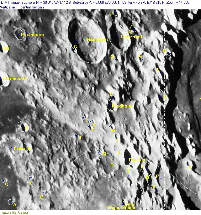
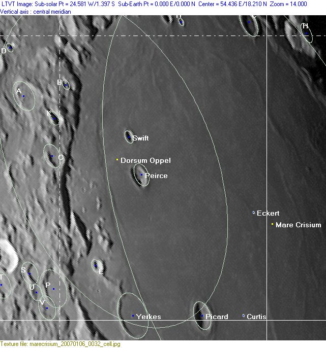
[#Rükl Zone 26 - CLEOMEDES-Lettered Crater Locations Lettered Crater Locations]
[#Rükl Zone 26 - CLEOMEDES-Additional Information Additional Information]
[#Rükl Zone 26 - CLEOMEDES-Candidate Apollo landing site Candidate Apollo landing site]
| 26 |
||
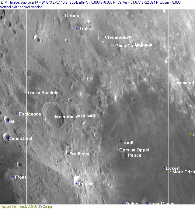
Photographic Map
(This map is based on an Earth-based photograph that has been computer-corrected to zero libration. The vertical white lines indicate the left and right boundaries of the Rükl rectangle)

  Background image source
Named Features
- Andradae (Van Langren's disallowed name for Mare Crisium Omega) (at the northwestern part of Mare Crisium).
- Cleomedes (Van Langren's Moura, J.Hewelcke's Montes Riphaei).
- Cleomedes Alpha (the somewhat elongated central peak of Cleomedes) (see also chart SLC A3) (System of Lunar Craters).
- Cooke (a disallowed name from H.P.Wilkins for the subdued crater Eimmart C at the northeastern coastline of Mare Crisium).
- Curtis (craterlet east of Picard) (this craterlet was something of a mystery in the days of T.W.Webb and his Celestial Objects for Common Telescopes).
- Debes
- Delmotte
- Dorsum Oppel
- Eckert
- Facula Alani (an unofficial name from D.Caes for the exceptionally bright spot at the northwestern part of Mare Crisium's rim).
- Fredholm
- Lacus Bonitatis (see Chart 25) (J.Hewelcke's Paludes Cimmeriae).
- Lavinium Promontorium (discontinued (?) IAU name).
- Macrobius (Van Langren's Tucheri, J.Hewelcke's Mons Cimmerius).
- Mare Crisium (Van Langren's Mare Caspium (de Moura), occupying the lower right section of Chart 26, see Chart 27 for wiki-link) (J.Hewelcke's Palus Maeotis).
- Mare Crisium Delta (peak or hill in the western part of Mare Crisium's rim, north-northwest of Yerkes E).
- Mare Crisium Rho (pronounced part of J.Hewelcke's Montes Alani, west of Facula Alani) (for Mare Crisium Delta and Rho, see Chart 33 in the Times Atlas of the Moon).
- Montes Alani (J.Hewelcke's disallowed name for the northern part of Mare Crisium's rim, called the Wasatch mountains by C.A.Wood).
- Olivium Promontorium (discontinued (?) IAU name).
- O'Neill's Bridge (an unofficial name, popular clair-obscur effect) (also called Flying Eagle and Eagle Gate, see Sky and Telescope April 1956).
- Palus Somni (Van Langren's Aestuaria Bamelrodia, J.Hewelcke's Lacus Corocondametis) (occupying the lower left section of Chart 26, see Chart 37 for wiki-link).
- Peirce
- Picard (J.Hewelcke's Insula Alopecia) (the island of baldness?).
- Proclus (Van Langren's Puteani, J.Hewelcke's Mons Corax).
- Rima Cleomedes
- Schwanzende (a very rare nickname from J.H.Franz for Mare Anguis T, source: Named Lunar Formations by Mary Blagg).
- Swift (once called Graham by H.P.Wilkins).
- Terra Sapientiae (Van Langren's disallowed name for the region north-northwest of Mare Crisium).
- Terra Vitae (Riccioli's discontinued name for the region north-northwest of Mare Crisium).
- Tisserand (see Additional Information below for candidate Apollo landing site).
- Torii (Van Langren's disallowed name for Mare Crisium Tau) (?) (E.A.Whitaker seems to have been uncertain about that one) (note: on Van Langren's map it is located at the most northern part of Mare Crisium).
- Tralles
- Wasatch mountains (C.A.Wood's name for J.Hewelcke's Montes Alani).
- Yerkes
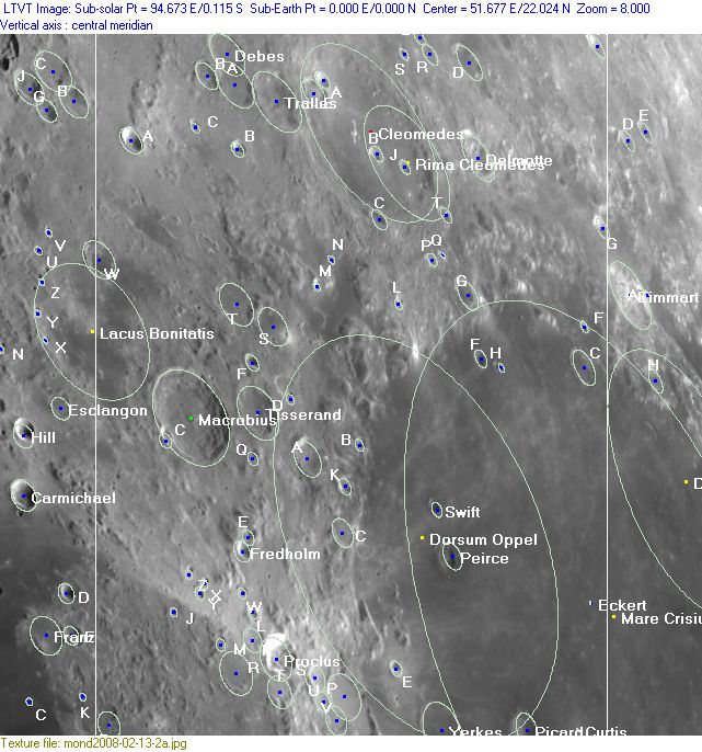
Lettered Crater Locations
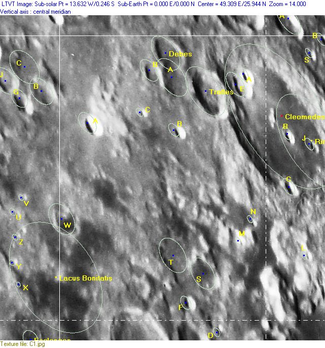
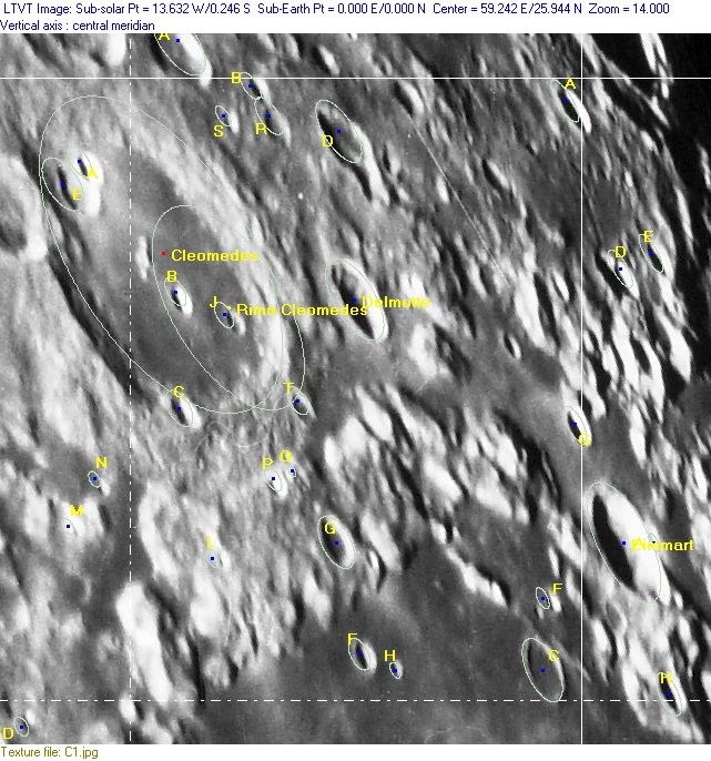
(click on the thumbnails to display full-sized images; use browser BACK button to return - the dashed white lines are the midpoints of the Rükl zones)

  Full zone with lettered craters:


  Lettered craters by quadrants:
| North West |
North East |
| South West |
South East |
Additional Information
- Other online descriptions of features in this Rükl map section:
Candidate Apollo landing site
According to page 25-76 in NASA's Apollo 15 Preliminary Science Report, there should have been a candidate Apollo landing site at 19°30' North/ 48°30' East (south of Tisserand, northeast of Fredholm). This site seems to have been called the Candidate Proclus Apollo Landing Site.
This page has been edited 1 times. The last modification was made by - tychocrater tychocrater on Jun 13, 2009 3:24 pm - mgx2
