Rükl 46
Contents
Rükl Zone 46 - THEOPHILUS
Neighboring maps on the Rükl Nearside Map:
Table of Contents
[#Rükl Zone 46 - THEOPHILUS Rükl Zone 46 - THEOPHILUS]
[#Rükl Zone 46 - THEOPHILUS-Photographic Map Photographic Map]
[#Rükl Zone 46 - THEOPHILUS-Named Features Named Features]
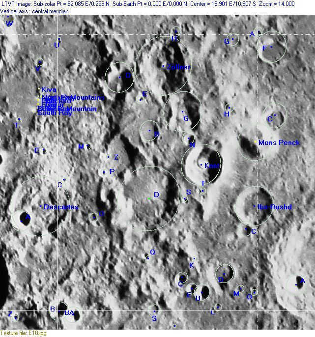
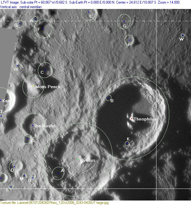
[#Rükl Zone 46 - THEOPHILUS-Lettered Crater Locations Lettered Crater Locations]
[#Rükl Zone 46 - THEOPHILUS-Lettered Crater Locations-Full zone with lettered craters Full zone with lettered craters]
[#Rükl Zone 46 - THEOPHILUS-Lettered Crater Locations-Lettered craters by quadrants Lettered craters by quadrants]
[#Rükl Zone 46 - THEOPHILUS-Additional Information Additional Information]
| 46 |
||
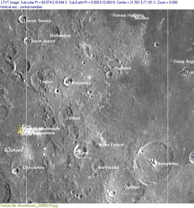
Photographic Map
(This map is based on an Earth-based photograph that has been computer-corrected to zero libration. The vertical white lines indicate the left and right boundaries of the Rükl rectangle)

  Background image source
Named Features
- Alfraganus
- A.Pavlov (somewhere east or east-southeast of Cyrillus should be a crater (or another surface formation) which was once known as A.Pavlov. This name is mentioned in the book THE MOON by A.V.Markov, but the I.A.U. did not accept that name).
- Caramuelis (Van Langren's disallowed name for the curious high-albedo region at the bowl-shaped craterlets Descartes C and Dollond E) (note: was this bright spot perhaps the eastern one of the three wise men which were depicted as stars on the map made by Melchior a Briga in 1747? See: Tres S.S.Reges Magi on pages 90-91 in E.A.Whitaker's Mapping and Naming the Moon).
- Chuck Hole (an informal NASA related name for a crater west of Moltke, in U.S Highway Number One, aka Rimae Hypatia).
- Cyrillus (Van Langren's Ferd. Caroli Leop. F., J.Hewelcke's Mons Moschus).
- The cluster of central peaks at Cyrillus seems to have been called Cyrillus Alpha, Cyrillus Delta, and Cyrillus Eta.
- Delambre (Van Langren's Crani, J.Hewelcke's Mons Amanus, Riccioli's S. Dionysius Areop.).
- Delambre Epsilon (elevation south of Delambre) (see page 123 in Tony Dethier's Maanmonografieen) (the name Delambre Epsilon is not mentioned on Chart 57 in the Times Atlas of the Moon).
- Hypatia
- Ibn-Rushd (once called Rossard by F.C.Lamech).
- Kant (Van Langren's Pironi).
- Kant Plateau (an informal name, see page Kant).
- Little Moltke (an informal NASA related name for the small bowl shaped crater Moltke B, east-southeast of Moltke itself).
- Lost Valley (an informal NASA related name for the bay-like depression east-southeast of Hypatia C).
- Mare Tranquillitatis (Van Langren's Mare Belgicum) (a tiny bit of its southwestern section at Moltke and Rimae Hypatia is seen at the upper right corner of Chart 46).
- Moltke
- Mons Penck
- Prom. Chadisia (J.Hewelcke's disallowed name for a certain region near Moltke).
- Prom. S. Ludovici (Van Langren's disallowed name for the region north of Hypatia).
- Rimae Hypatia (called U.S. Highway Number One during the early heydays of Project Apollo).
- Seneschali (Van Langren's disallowed name for Alfraganus Alpha).
- Sinus Asperitatis (Van Langren's Sinus Batavicus, J.Hewelcke's Sinus Atheniensis) (north of Theophilus, see Chart 47 for wiki link).
- Taylor (Van Langren's Ulloae, J.Hewelcke's Mons Tmolus).
- Terra Dignitatis (Van Langren's disallowed name for the western part of Chart 46).
- Terra Sanitatis (Riccioli's discontinued name for the western part of Chart 46).
- The Gashes (an informal NASA related name for the cluster of craterlets east-northeast of Moltke).
- Theophilus (Van Langren's Ferd. Francisci Imp. Rom. F., J.Hewelcke's Mons Moschus).
- The cluster of central peaks at Theophilus seems to have been called Theophilus Alpha, Theophilus Phi, and Theophilus Psi.
- Thud Ridge (an informal NASA related name for the oblong hill near the upper right corner of Chart 46).
- Worm Rille (an informal NASA related name for the irregular trough just north of Chuck Hole, west of Moltke).
- Zöllner (Van Langren's Trederi, J.Hewelcke's Mons Lipulus).
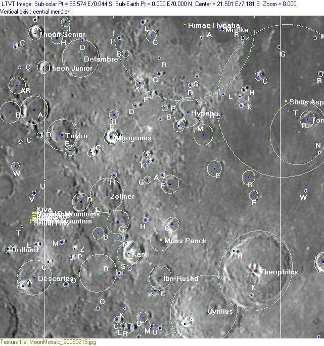
Lettered Crater Locations
(click on the thumbnails to view full-sized images; use browser BACK button to return to this page)
Full zone with lettered craters
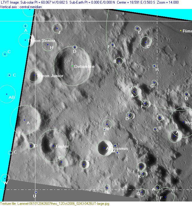
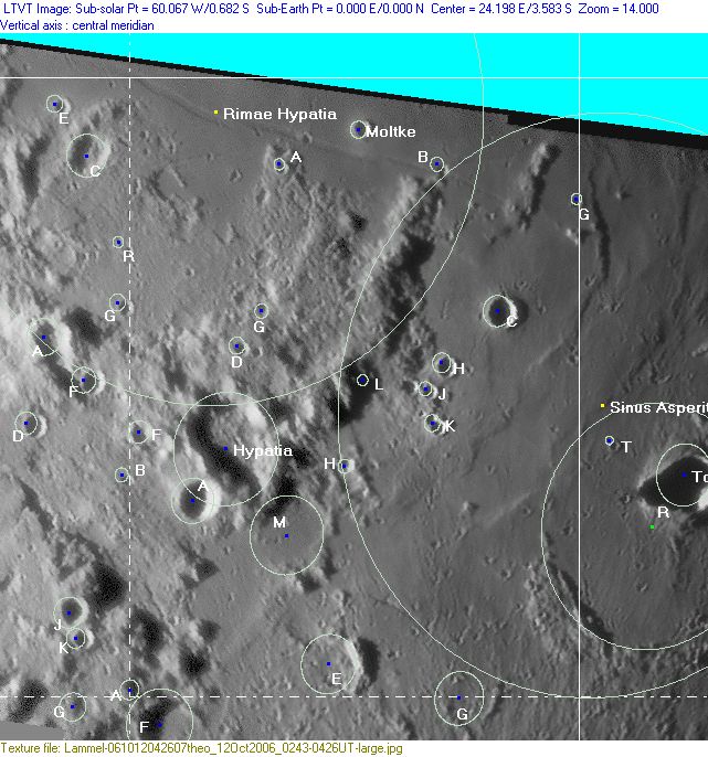
Lettered craters by quadrants
(the dashed white lines are the centerlines of the Rükl zones)
| North West |
North East |
| South West |
South East |
Additional Information
- Other online descriptions of features in this Rükl map section:
This page has been edited 1 times. The last modification was made by - tychocrater tychocrater on Jun 13, 2009 3:24 pm - mgx2
