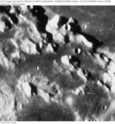
Lacus Gaudii
Contents
[hide]Lacus Gaudii
|
Lat: 16.2°N, Long: 12.6°E, Diam: 113 km, Depth: km, Rükl: 23 |
Consolidated Lunar Atlas -- Plate C8 Lacus Gaudii is the dark mare-floored region in the center of this frame. To its north, across the Montes Haemus, is the southwestern shore of Mare Serenitatis. To its south are 50-km Lacus Hiemalis (on the right) and 80-km Lacus Lenitatis (bisected by the bottom margin).
Images
LPOD Photo Gallery Lunar Orbiter Images Apollo Images
To detect the location of a less-known region such as Lacus Gaudii on orbital photographs made during the Apollo program is a real pleasure.
Apollo 17's oblique southward looking Fairchild camera photograph AS17-M-2420 shows Lacus Gaudii slightly leftward of the frame's centre. Earlier in the mission, it was captured at centre of frame AS17-M-1667.
Research Danny Caes
Maps
(LAC zone 42D4) LAC map Geologic map LM map LTO map
Description
Description: Wikipedia
Additional Information
Nomenclature
"Lake of Joy"
- This name was approved "as now assigned and printed on the 1:250,000 lunar map series" in 1976 (IAU Transactions XVIB). The name appears on LTO-42D4.
LPOD Articles
Bibliography
