Difference between revisions of "Street"
| (One intermediate revision by the same user not shown) | |||
| Line 6: | Line 6: | ||
|} | |} | ||
<div id="toc"> | <div id="toc"> | ||
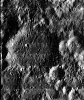
| − | + | [[Image:Street_LO_iv_119_h2.jpg|external image Street_LO_iv_119_h2.jpg]]<br /> ''[http://lpod.org/coppermine/displayimage.php?pos=-1776 LOIV 119 H2]''<br /> <br /> | |
| − | |||
==Images== | ==Images== | ||
[http://www.lpod.org/coppermine/thumbnails.php?album=search&type=full&search=Street LPOD Photo Gallery] [http://www.lpi.usra.edu/resources/lunar_orbiter/bin/srch_nam.shtml?Street%7C0 Lunar Orbiter Images] [http://www.lpi.usra.edu/resources/apollo/search/feature/?feature=Street Apollo Images]<br /> | [http://www.lpod.org/coppermine/thumbnails.php?album=search&type=full&search=Street LPOD Photo Gallery] [http://www.lpi.usra.edu/resources/lunar_orbiter/bin/srch_nam.shtml?Street%7C0 Lunar Orbiter Images] [http://www.lpi.usra.edu/resources/apollo/search/feature/?feature=Street Apollo Images]<br /> | ||
| Line 18: | Line 17: | ||
<br /> | <br /> | ||
==Description: Elger== | ==Description: Elger== | ||
| − | ''([[IAU% | + | ''([[IAU%20directions|IAU Directions]])'' STREET.--A walled-plain between [[Tycho|Tycho]] and [[Maginus|Maginus]], about 28 miles in diameter, with a border of moderate height, broken by depressions on the N. There are some small craters and ridges within; but the surrounding region, with its almost endless variety of abnormally shaped formations, is far more worthy of the observer's attention.<br /> <br /> |
==Description: Wikipedia== | ==Description: Wikipedia== | ||
[http://en.wikipedia.org/wiki/Street_(crater) Street]<br /> <br /> | [http://en.wikipedia.org/wiki/Street_(crater) Street]<br /> <br /> | ||
==Additional Information== | ==Additional Information== | ||
| − | * Depth data from [[Kurt%20Fisher% | + | * Depth data from [[Kurt%20Fisher%20Crater%20Depths|Kurt Fisher database]] |
** Westfall, 2000: 2.67 km | ** Westfall, 2000: 2.67 km | ||
** Viscardy, 1985: 1.5 km | ** Viscardy, 1985: 1.5 km | ||
| Line 40: | Line 39: | ||
<br /> <br /> | <br /> <br /> | ||
---- | ---- | ||
| − | + | </div> | |
Latest revision as of 03:18, 16 April 2018
Contents
Street
|
Lat: 46.5°S, Long: 10.5°W, Diam: 57 km, Depth: 2.67 km, Rükl: 64 |
Images
LPOD Photo Gallery Lunar Orbiter Images Apollo Images
- A possible concentric crater is noticeable on the floor of Street M (west-southwest of Street itself, and south-southwest of Tycho). It was captured on the lower part of Lunar Orbiter 4's photograph LOIV-124-H2. Only the western part of this possible CC shows a "double rim", which makes it an interesting target for dedicated observers of this region on the moon.
- Research: Danny Caes
Maps
(LAC zone 112D4) LAC map Geologic map
Description
Description: Elger
(IAU Directions) STREET.--A walled-plain between Tycho and Maginus, about 28 miles in diameter, with a border of moderate height, broken by depressions on the N. There are some small craters and ridges within; but the surrounding region, with its almost endless variety of abnormally shaped formations, is far more worthy of the observer's attention.
Description: Wikipedia
Additional Information
- Depth data from Kurt Fisher database
- Westfall, 2000: 2.67 km
- Viscardy, 1985: 1.5 km
- Cherrington, 1969: 1.7 km
- West-southwest of Street, in Street M, is a craterlet with double western rim. Is it a Concentric Crater? The craterlet's location is 48° South/ 14° West.
- Included on the ALPO list of banded craters
Nomenclature
- Named for Thomas Street (1621 - 1689), an English astronomer. A follower of Johannes Kepler, Street published a number of books, including Ephemerides, the most notable of which is his Astronomia Carolina (1661). Newton is said to have learned of Kepler's laws from reading it.
- The name was introduced by Johann Schröter (plate T. LV)
LPOD Articles
14 inches of Tycho (shows Street M too, with possible Concentric Crater on its floor, by George Tarsoudis).
Bibliography
