König
Contents
König
|
Lat: 24.23°S, Long: 24.74°W, Diam: 22.95 km, Depth: 2.44 km, Rükl: 53 |

Images
LPOD Photo Gallery Lunar Orbiter Images Apollo Images
- Konig was also captured by Apollo 16's south looking mapping/metric Fairchild camera, such as in Frame AS16-M-2495, in which Konig is noticeable very near the central part of the curved horizon.
- Research: Danny Caes.
Maps
(LAC zone 94D2) LAC map Geologic map
Description
Wikipedia
Additional Information
- IAU page: König
- Depth data from Kurt Fisher database
- Arthur, 1974: 2.44 km
- Westfall, 2000: 2.44 km
- Viscardy, 1985: 2.44 km
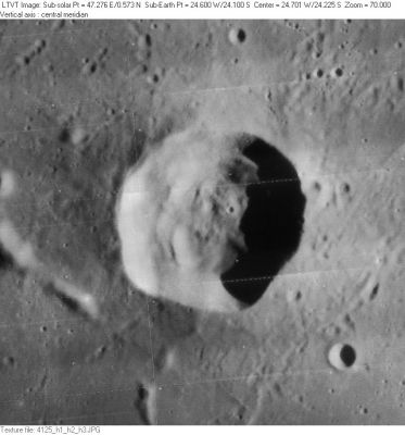
- From the shadows in LO-IV-125H, König is up to about 2400 m deep. - Jim Mosher
- König is on the ALPO list of banded craters
Nomenclature
- Named for Rudolf König (1865-1927), an Austrian mathematician, astronomer. In lunar studies, König is noted for completing and publishing the second set of Johann Krieger's Atlas, as well as for an very excellent 17-inch map of the Moon's full disk, apparently of his own construction.
- Named by Karl Müller in Named Lunar Formations in 1935 (Whitaker, p 229).
- A hill west-northwest of Konig seems to have been called Phi (see Chart 80 in the Times Atlas of the Moon). Was this Konig Phi or Hippalus Phi?
Lettered Craters

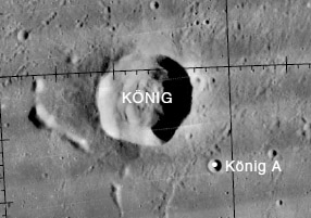
Excerpt from the USGS Digital Atlas of the Moon.
LPOD Articles
Bibliography
- Hill, Harold. 1991. A Portfolio of Lunar Drawings., pages 110, 111.
- Rheden, J. 1927. Anzeige des Todes von Rudolf König. Astronomische Nachrichten, volume 229, p. 335.
Named Features -- Prev: Kondratyuk -- Next: Konoplev