Dorsum Cloos
Contents
Dorsum Cloos - in the northeastern part of Mare Smythii
| Lat: 1.15°N, Long: 90.4°E, Length: 103.09 km, Height: km, Rükl: (farside) |
Table of Contents
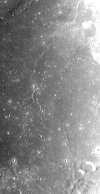
Left: LROC image WAC No. M119265479ME. Calibrated by LROC_WAC_Previewer.
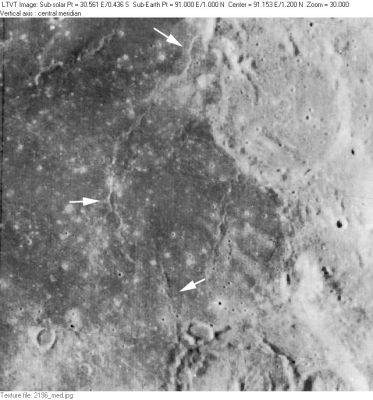
Right: LO-II-196M Dorsum Cloos crosses Mare Smythii along the path indicated by the white arrows in this relatively high sun Lunar Orbiter view. The 45-km crater in the upper right is McAdie and the similarly-sized one partially visible along the bottom margin is Purkyne U (the LTO's Tasso). The ridge in the upper right is part (the only part?) of the Dorsa Dana system. The separate ridge extending south from the southwest rim of McAdie (to the right of the lowest arrow) is unnamed. It is not entirely clear from the labeling on LTO-64D4 if the short strongly shadowed ridge running north from the tip of the lowest arrow was intended to be part of Dorsum Cloos or not.
Images
LPOD Photo Gallery Lunar Orbiter Images Apollo images (Mare Smythii).
Maps
Description
Wikipedia
Additional Information
- IAU page: Dorsum Cloos
Nomenclature
- Named for Hans Cloos (November 8, 1885 - September 26, 1951), a prominent German structural geologist. Following World War I, he began a study of plutons and their interior structure. Professor Hans Cloos made pioneering studies of rock deformation, including granite tectonics. He employed scale models to study the physical mechanics of faulting, and examined how continents developed their structure.
And he studied volcanoes, one of the few who did in the first half of the 20th century. He became my hero and I read his well-written and philosophical autobiography: Conversations with the Earth. - tychocrater tychocrater Oct 28, 2007 - Dorsum Cloos was among the feature names approved "as now assigned and printed on the 1:250,000 lunar map series" (LTO's) in 1976 (IAU Transactions XVIB). The name appeared provisionally on LTO-64D4.
LROC Posts
Post 953: NAC Anaglyph: Dorsum Cloos (from Kristen Paris).
Bibliography
Named Features -- Prev: Clerke -- Next: Coblentz
This page has been edited 1 times. The last modification was made by - tychocrater tychocrater on Jun 13, 2009 3:24 pm - afx3u3

