Gruithuisen
Contents
Gruithuisen
|
Lat: 32.88°N, Long: 39.77°W, Diam: 15.88 km, Depth: 1.87 km, Rükl: 9 |
Images
LPOD Photo Gallery Lunar Orbiter Images Apollo Images
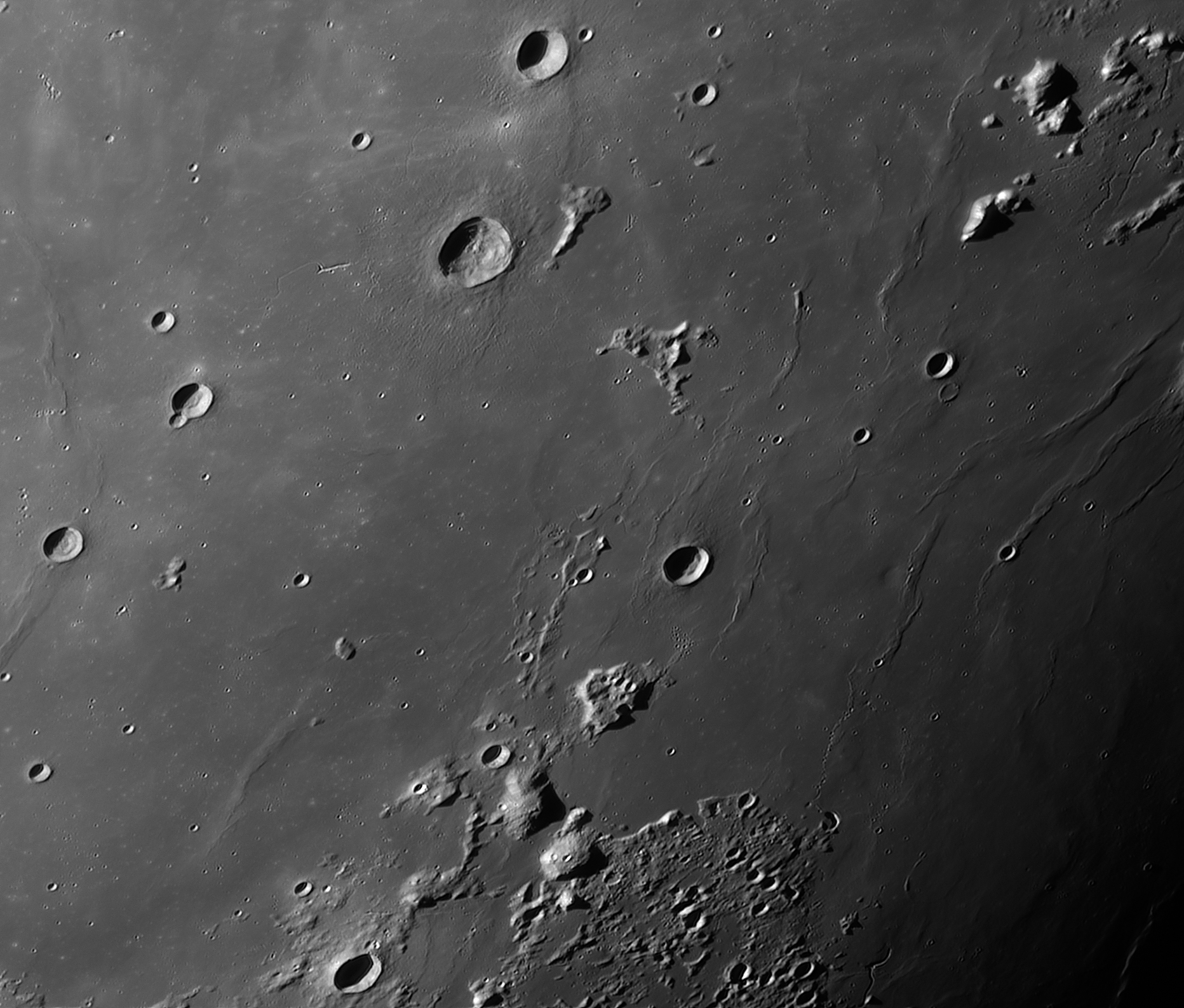
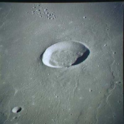
- At about 100 kilometers west-northwest of Gruithuisen one could detect a chain of 30 teardrop-shaped craterlets, once photographed by CMP Alfred Worden of Apollo 15. One of these orbital color Hasselblad-photographs appeared on page 252 of the article To the Mountains of the Moon by Kenneth F. Weaver, National Geographic Magazine, February 1972. There's a total of 6 Hasselblads of that chain. They are: AS15-93-12724 to 12729 (Magazine P/93). One of them (AS15-93-12725) shows both the chain (centre of photo) and concentric crater Gruithuisen K in the upper right corner. Research: - DannyCaes Feb 24, 2008
- The cluster of bowl-shaped craterlets north-northwest of Gruithuisen (south-southwest of Gruithuisen Zeta) is nicknamed Gruithuisen's Mob by Danny Caes (see photo AS15-93-12719, above). This cluster (and also the chain near Gruithuisen K) is a very interesting target for today's webcam-imagers of the moon's surface. - DannyCaes Feb 24, 2008, see also LPOD Geo Textbook.
- Lunar Orbiter 5's Frame 183-med shows a wonderful vertical view of the Gruithuisen complex (Mons Gruithuisen Delta and Gamma, the teardrop-shaped chain near the concentric crater Gruithuisen K (near the photograph's upper left corner), and the craterlet-cluster near Gruithuisen Zeta). - DannyCaes Feb 24, 2008
- Gruithuisen itself was captured on Apollo 15's panoramic ITEK-camera frames AS15-P-10306 and AS15-P-10311 (at both frames, scroll to the rightward margins to see Gruithuisen). Research: Danny Caes
- Christian Viladrich's excellent telescopic webcam-image of the Gruithuisen region (made during local morning light) shows very well the chain of craterlets west-northwest of Gruithuisen itself, see:

Maps
(LAC zone 23C3) LAC map Geologic map
Description
Elger
(IAU Directions) GRUITHUISEN.--This ring-plain, 10 miles in diameter, is situated on the Mare Imbrium on the N.W. of Delisle. It is associated with a number of ridges trending towards the region N. of Aristarchus and Herodotus.
Wikipedia
Additional Information
- IAU page: Gruithuisen
- Depth data from Kurt Fisher database
- Arthur, 1974: 1.87 km
- Westfall, 2000: 1.87 km
- Viscardy, 1985: 1.86 km
- Gruithuisen K is a concentric crater.
- TSI = 20, CPI = 5, FI = 20; MI =45 Smith and Sanchez, 1973
- Unexplored Areas of the Moon: Nonmare DomesA White Paper submitted to the Planetary Science Decadal Survey 2013-2022 - astrokat astrokat Aug 6, 2010
- Primary Author: Sarah E. Braden
- School of Earth and Space Exploration, Arizona State University
- Short chain of four connected craters on the somewhat triangle-shaped elevation Gruithuisen Zeta, see LPOD Geo Textbook.
Nomenclature
- Named for Franz von Gruithuisen (1774-1852), a German astronomer. Gruithuisen was one of the first to suggest that the Moon's craters might be the result of meteorite impacts, and produced several credible maps of the Moon, as well as many detailed drawings, but will probably always be best remembered for his announcement of an illusory lunar city which he believed he had discovered (north of Schroter).
- A small hill east of Gruithuisen and south of Gruithuisen H is called Delise alpha on Chart 15 of the Times Atlas of the Moon. The name Delise should be Delisle, and I guess it must be Gruithuisen alpha instead of Delisle alpha. By the way, the LRO's online Act-React Quick Map shows a curious "intestine" to the east of Gruithuisen alpha, very much looking like those in the neighbourhood of Prinz. Research: Danny Caes
- Alfred Worden's Chain. This is the chain of 30 teardrop-shaped craterlets at about 100 kilometers west-northwest of Gruithuisen, once photographed by CMP Alfred Worden of Apollo 15. Alfred Worden was the first who made photographs of it with handheld Hasselblad camera. Today it is possible to take images of it through common telescopes with attached webcams.
- GEM: the Gruithuisen E and M region of Irregular Mare Patches (IMPs).
- Many unnamed sinuous rilles in the neighbourhood of Gruithuisen need their own official name!
LPOD Articles
- Low Sun Paradise
- Braided Rille (the rare catena-like string west-northwest of Gruithuisen, photographed by Kaguya).
- Geo Textbook (all sorts of curious features near Gruithuisen, photographed by Kaguya).
Bibliography
- Tran, T. et al (2011). Morphology of Lunar Volcanic Domes from LROC – 42nd LPSC Conference (Mar), 2011.
- Hill, Harold. A Portfolio of Lunar Drawings, pages 90, 91.
- The string of teardrop-shaped craterlets W.N.W. of Gruithuisen:
- Geologie Auf Dem Mond (Guest and Greeley), seite 140, abbildung 7.8. (NASA Lunar Orbiter V 182 M).
- Apollo Over the Moon, Chapter 6: Rimae (Part 2: Sinuous Rimae, continued), Figure 197.
- List of Lunar white papers being prepared as input for the Planetary Science Division Decadal Survey process is linked to the LEAG page- astrokat astrokat Aug 6, 2010
Franz von Paula Gruithuisen's "Lunar City" (north of Schroter):
- Baum, R. 1992. The Man who found a City in the Moon. Journal of the British Astronomical Association, vol. 102, no.3, pp. 157-159.
- Birt, W. R. 1870. Gruithuisen's City in the Moon. Astronomical Register, vol. 8, pp. 179-180.
- Hill, Harold. 1991. A Portfolio of Lunar Drawings. Pages 46-47.
- Robinson, Walt. 2005. "Our Nearest Neighbor, X". Cosmic Messenger (Astronomical Society of Kansas City), No. 10, pp. 4-5. (PDF)
- Sheehan, William P. and Dobbins, Thomas A. 2001. Epic Moon; a history of lunar exploration in the age of the telescope. Chapter 7: The Moon's White Cities.
- Wanders, A.J.M. 1949. Op Ontdekking in het Maanland. Plate XX-b.
- Webb, T.W. Celestial Objects for Common Telescopes, Volume 1; The Solar System. Pages 119-120.
- Whitaker, Ewen A. 1999. Mapping and Naming the Moon; a history of lunar cartography and nomenclature. Pages 109-110.
- Whitley, H. Michell. 1870. Gruithuisen's City in the Moon. Astronomical Register, vol. 8, pp. 156-157.
Franz von Paula Gruithuisen in the Sourcebook Project (William R. Corliss)
- In Mysterious Universe, a handbook of astronomical anomalies (1979) :
- Pages 97 and 99: On the Visibility of the Dark Side of Venus (A.Schafarik, Report of the British Association, 1873).
- Page 116: The Radial Markings of Venus and their Modern Resurrection (James C. Bartlett Jr., Strolling Astronomer, 1955).
- Page 129: Notes on the Rotation Period of Venus (E.M.Antoniadi, Monthly Notices of the Royal Astronomical Society, 1898).
- Page 166: Abnormal Appearance of the Lunar Crescent (B.J.Hopkins, Observatory, 1883).
- Page 198: The Linne Controversy: a look into the past (Patrick Moore, Journal of the British Astronomical Association, 1977).
- Page 216: Curious Lunar Formation (C.Gaudibert, English Mechanic, 1874). Note: this curious formation is Gruithuisen's so-called "Lunar City" near crater Schroter.
Named Featues -- Prev: Mons Gruithuisen Gamma -- Next: Guericke
