Rükl 68
Rükl Zone 68 - RHEITA
Neighboring maps on the Rükl Nearside Map:
Table of Contents
[#Rükl Zone 68 - RHEITA Rükl Zone 68 - RHEITA]
[#Rükl Zone 68 - RHEITA-Photographic Map Photographic Map]
[#Rükl Zone 68 - RHEITA-Named Features Named Features]
[#Rükl Zone 68 - RHEITA-Lettered Crater Locations Lettered Crater Locations]
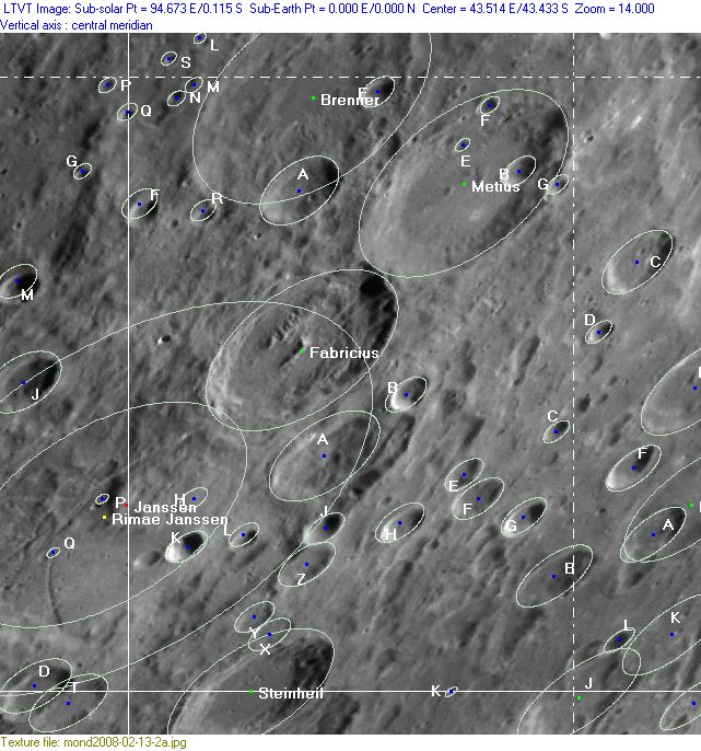
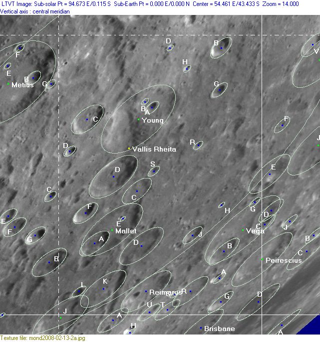
[#Rükl Zone 68 - RHEITA-Lettered Crater Locations-Full zone with lettered craters Full zone with lettered craters]
[#Rükl Zone 68 - RHEITA-Lettered Crater Locations-Lettered craters by quadrants Lettered craters by quadrants]
[#Rükl Zone 68 - RHEITA-Additional Information Additional Information]
[#Rükl Zone 68 - RHEITA-The Piccolomini-Rheita boundary of Riccioli's Terra Fertilitatis and Terra Vigoris The Piccolomini-Rheita boundary of Riccioli's Terra Fertilitatis and Terra Vigoris]
| 68 |
||
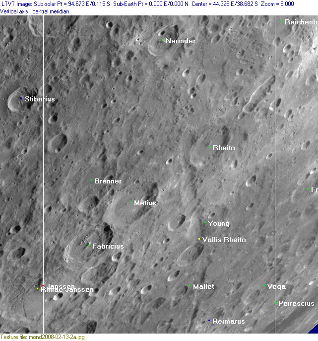
Photographic Map
(This map is based on an Earth-based photograph that has been computer-corrected to zero libration. The vertical white lines indicate the left and right boundaries of the Rükl rectangle)

  Background image source
Named Features
- Brenner (J.Hewelcke's Montes Coibacarani, Riccioli's Metius).
- Claramontius (Riccioli's disallowed name for a dark region southeast of Fabricius, Metius, and Rheita) (could it have been part of the region nowadays known as Mare Australe?).
- Fabricius (Van Langren's Fred. C. Pal., J.Hewelcke's Montes Coibacarani).
- Greek Theater Mask (a nickname from D.Licchelli for a clair-obscur phenomenon at Fabricius, with Janssen J and Janssen K, always appearing during local sunset circumstances, see LPOD Greek Theater Mask).
- Mallet
- Metius (Van Langren's Caroli D. Loth., J.Hewelcke's Montes Coibacarani, Riccioli's Mulerius).
- Mini Schiller (a nickname from D.Caes for the oblong formation Rheita E).
- Neander
- Neander Fault (east-southeast of Neander itself, this informal name is printed on chart 6 of the 21st Century Atlas of the Moon, C.A.Wood, M.J.S.Collins).
- Peirescius (near the lower right corner of Chart 68).
- Piccolomini (Van Langren's Noyelles, J.Hewelcke's Montes Sogdiani) (the southeastern part of this large crater is seen at the upper left corner of Chart 68).
- Reichenbach Valley (possibly the oblong formation Rheita E to the south-southeast of Reichenbach, called Reichenbach Valley on page 41 of Patrick Moore's The Guinness Book of Astronomy, Facts and Feats, 1983).
- Reimarus
- Rheita
- Steinheil (Van Langren's Zamosci, together with Watt on Chart 76) (the northern part of Steinheil is seen a bit to the right of the lower left corner of Chart 68).
- Terra Fertilitatis (Riccioli's discontinued name for the upper right section of Chart 68).
- Terra Vigoris (Riccioli's discontinued name for the lower left section of Chart 68).
- Vallis Rheita
- Vega
- Young
An extra "name":
- The Piccolomini-Rheita boundary (see Additional Information below).
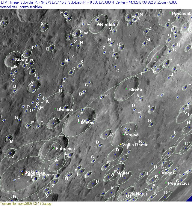
Lettered Crater Locations
(click on the thumbnails to view full-sized images; use browser BACK button to return to this page)
Full zone with lettered craters
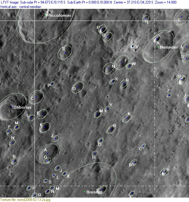
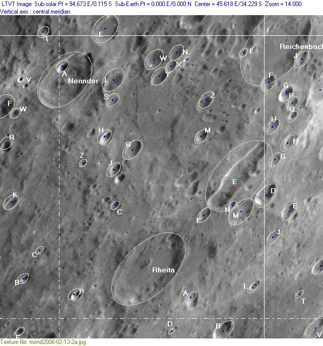
Lettered craters by quadrants
(the dashed white lines are the centerlines of the Rükl zones)
| North West |
North East |
| South West |
South East |
Additional Information
- Other online descriptions of features in this Rükl map section:
The Piccolomini-Rheita boundary of Riccioli's Terra Fertilitatis and Terra Vigoris
A.J.M.Wanders (of the Dutch moonbook Op Ontdekking in het Maanland, 1949) depicted several sections of the boundary of Riccioli's Terra Fertilitatis and Terra Vigoris on Quadrant 1 of his moonmap. One of those sections is the one between Piccolomini and Rheita (see Rukl's Chart 68 above). It is not known if Riccioli himself thought about boundaries between his terra regions. We shall never know, because none of those boundaries is visible on Grimaldi's map in which Riccioli included his nomenclature. Or is there perhaps another ancient map which shows the boundaries? - DannyCaes DannyCaes Jan 15, 2016
This page has been edited 1 times. The last modification was made by - tychocrater tychocrater on Jun 13, 2009 3:24 pm - mgx2
