Rima Dawes
Contents
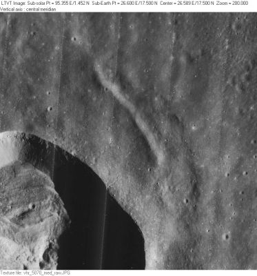
Rima Dawes - the "bow wave" or "bow shock" NE and SE of crater Dawes itself
|
Lat: 17.5°N, Long: 26.6°E, Length: 15 km, Depth: km, Rükl: 24 |
LO-V-070M Rima Dawes is the depression to the northeast of the 18-km diameter Dawes (the deeply shadowed crater in the lower left).
Images
LPOD Photo Gallery Lunar Orbiter Images Apollo Images
Maps
(LAC zone 42C3) LAC map Geologic map LM map LTO map
Description
Description: Wikipedia
Additional Information
Rima Dawes looks very much like a "bow wave" or "bow shock" immediately east of Dawes itself. It's as if crater Dawes is moving eastward through the northern part of the Sea of Tranquillity. See also http://bit.ly/2v3uqWo
Nomenclature
- Named from nearby crater. (Dawes)
- This name was provisionally assigned on Topophotomap 42C3(S4) (1976). It was "approved as assigned" in 1985 (IAU Transactions XIXB).
LPOD Articles
Bibliography
