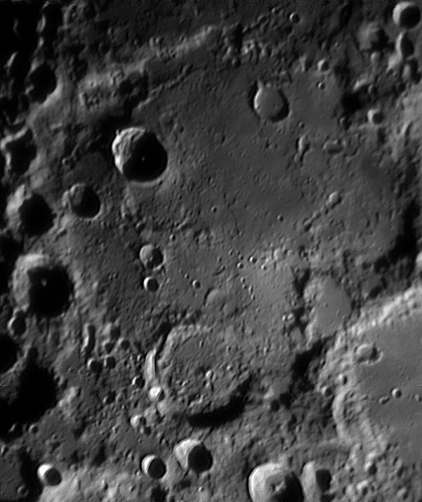
Deslandres
Contents
Deslandres (aka Fauth's Horbiger)
|
Lat: 33.1°S, Long: 4.8°W, Diam: 256 km, Depth: 1.58 km, Rükl: 64 & 65, pre-Nectarian |
Images
LPOD Gallery Lunar Orbiter Images Wes Higgins images
Maps
(LAC zone 112A2) LAC map Geologic map
IAU page: Deslandres
Description
Description: Elger
(IAU Directions) (under Lexell): On the W. of Walter extends an immense plain of irregular outline, which is at least equal to it in area. Though no large formation is found thereon; many ridges, short crater-rows, and ordinary craters figure on its rugged superficies; and on its borders stand some very noteworthy objects, among them, on the S., the walled-plain Lexell ...
Description: Wikipedia
Additional Information
- Depth data from Kurt Fisher database
- Westfall, 2000: 1.58 km
- Cherrington, 1969: 3.5 km
Nomenclature
- Named for Henri Alexandre Deslandres (July 24, 1853 – January 15, 1948), a French astronomer, director of the Meudon and Paris Observatories. Deslandres was the 1921 Bruce medalist of the Astronomical Society of the Pacific, and extensive links to information about him can be found there.
- According to Whitaker (p. 171), the name Deslandres was suggested by E. Antoniadi in 1942 and was the only name approved at the 1948 General Assembly of the IAU. Prior to this, the region was primarily known by the informal name of Hell Plain, after the named crater (Hell) within it. However, Fauth used the name Hörbiger, honoring Hanns Horbiger, an Austrian cosmologist who fathered a weird theory of an ice-covered Moon, much favored by the Nazis. Perhaps Antoniadi's proposal was intended to supress further use of that name. Surprisingly Wilkins and Moore use the name Hörbiger even though their book was published well after the IAU resolution. Perhaps Wilkins' map, on which the book is based, had been prepared earlier. - Jim Mosher
- Several reproduced examples of Hans Schwarzenbach's well-known Hallwag moonmap show the name Horbiger between brackets, printed under the official name Deslandres.- DannyCaes Jun 4, 2014
- Schröter's name Hell was (according to Elger, 1893), actually originally intended to refer to the entire region currently known as Deslandres, but (according to Neison, 1876) the meaning was "restricted" to the much small crater that currently bears that name by Mädler, hence a new name had to be invented. - Jim Mosher
- Erroneously printed as Deslandes (without "r") on page 13 (nearside map) in the 21st Century Atlas of the Moon (2012). - DannyCaes Jan 23, 2013
LPOD Articles
Hell Plain A Floorful of History Deslandes South The Left Side of Hell
Bibliography
- Elger, T. G. 1893. Selenographical notes: Lexell and its Surroundings. The Observatory, Vol. 16, pp. 355-356
- Fauth's "Horbiger" (Deslandres): Sky And Telescope, November 1959, page 23 (Fauth's detailed map of the "Horbiger" region).
