Riccioli
Contents
Riccioli
|
Lat: 2.9°S, Long: 74.37°W, Diam: 155.66 km, Depth: 2.85 km, Rükl: 39 |
Images
LPOD Photo Gallery Lunar Orbiter Images
- During the mission of Apollo 16 in april 1972, Riccioli was photographed in Earth light, see AS16-127-20019.
- During Apollo 17 in December 1972, crater Riccioli and its westward environs were also photographed in Earth light, when the lunar sunrise-terminator was still too eastward. During the whole time of Apollo 16's and Apollo 17's lunar orbits, the direct sunlight never reached Riccioli. These earthshine photographs are included in Apollo 17's Magazine 161-ZZ (35mm NIKON B&W photographs), see also: Sheet 8 of A17's Index Maps. Some of those photographs were reproduced in the Apollo 17 Preliminary Science Report. - DannyCaes Dec 22, 2007
Maps
(LAC zone 73B2) USGS Digital Atlas PDF
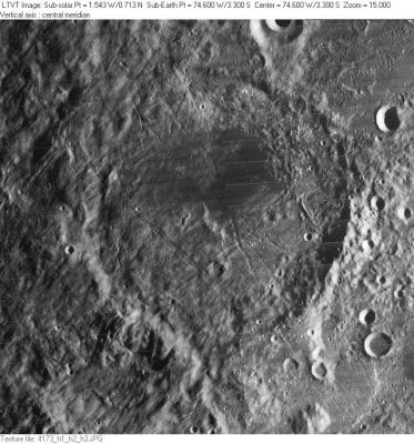
The dark spot on the floor of Riccioli is the only one of the moon's low-albedo regions which is included on the atlas of the SLC (System of Lunar Craters, 1966).
See SLC-F5.
Description
Elger
(IAU Directions) RICCIOLI.--An immense enclosure, near the limb, N.W. of Grimaldi, bounded by a rampart which is very irregular both in form and height, though nowhere of great altitude, and much broken by narrow gaps. It is especially low and attenuated on the N., where a number of ridges with intervening valleys traverse it. On the S. also a wide valley cuts through it. With the exception of a few low rounded hills and ridges, a short crater-row under the S.W. wall, and two small craters on the S.E., there are no details on the floor, which, however, is otherwise remarkable for the dusky tone of its surface, especially on the N. This dark patch occupies the whole of the N.W. side of the interior, and is bounded on the S. by an irregular outline, extending at one point nearly to the centre, and on the E. by a curved edge. The E. side is much darker than the rest. It is, in fact, as dark, if not darker, than any part of the floor of Grimaldi. Riccioli extends 106 miles from N. to S., and is ne
arly as broad. It includes an area of 9,000 square miles.
Wikipedia
Additional Information
- IAU page: Riccioli
- Depth data from Kurt Fisher database
- Westfall, 2000: 2.85 km
- Cherrington, 1969: 2.28 km
- A small area on the floor of Riccioli was selected as a Constellation Program Region of Interest.
Nomenclature
- Named for Giovanni Battista Riccioli (1598-1671); an Italian astronomer. Riccioli's most noted contribution to selenography was the publication, in his Almagestum novum (1651), of a map by his friend and former student Grimaldi on which Riccioli named the various features. Riccioli's system of giving craters the latinized names of scientists and philosphers, and inventing fanciful names for other landforms, such as the mare, was only one of many in use at the time. But it is the one that survived and formed the basis for the modern lunar nomenclature. To view an adaptation of Riccioli's map on-line, see the Two Ancient MoonsLPOD. - Jim Mosher
- Copies of Riccioli's book are on-line at Gallica (Vol. 1: Part 1 and Part 2 National Library of France) and at the ETH-Bibliothek Zürich.
From the Zurich copy:- Introductory material
- Pages XXVI-XXVIII: Riccioli's Chronological list of persons contributing to the history of astronomy.
- Pages XXVIII-XLVII: Riccioli's Biographical dictionary of persons contributing to the history of astronomy.
- Book 4 (the Moon)
- Between pages 168 & 169: Grimaldi's map with phases
- Followed by: Riccioli's Nomenclature map (the names are presumably drawn from the chronology and biographical dictionary)
- Pages 204-205: small Phase mapsfollowed by Riccioli's complete lunar nomenclature list by "Octant"
- Introductory material
- Riccioli's nomenclature map was also on display at a 2009 exhibit at the Science History Museum in Florence, which also has a complete copy of the book in its Digital Library (note the button in upper right to switch between volumes).
- Auctioned copy of Riccioli's book from the library of John Flamsteed.
- Linda Hall library zoomable copy of nomenclature map (full size, image only)
- Copies of Riccioli's book are on-line at Gallica (Vol. 1: Part 1 and Part 2 National Library of France) and at the ETH-Bibliothek Zürich.
- Wilkins and Moore proposed calling Riccioli C Ingalls and Riccioli E Harris. The I.A.U. did not accept these designations, although the name Ingalls was was later used for a farside crater. Harris was an English engineer.
Miyamori Valley
- East of Riccioli, running toward Lohrmann, is a formation which is sometimes called the Miyamori Valley. Although this name is not official, it is mentioned in several Moon books, such as Harold Hill's A Portfolio of Lunar Drawings, page 138 (drawing page 139).
LROC Articles
LPOD Articles
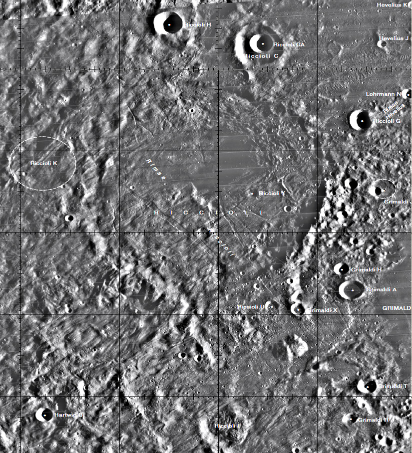
Lettered craters

Graphic LACs No. 55 and No. 73. Excerpt from the USGS Digital Atlas of the Moon.
Bibliography
- MacDonald, T. L. 1967. Riccioli and Lunar Nomenclature. JBAA 77, 112-117.
Named Featues -- Prev: Rhysling -- Next: Rimae Riccioli
