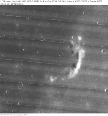
Aryabhata
Contents
Aryabhata
(formerly Maskelyne E)
|
Lat: 6.2°N, Long: 35.1°E, Diam: 22 km, Depth: 0.65 km, Rükl: 36 |
LO-IV-073H This apparent fragment of a ruined crater rim is located about 130 km southwest of the center of Mare Tranquillitatis.
Images
LPOD Photo Gallery Lunar Orbiter Images Apollo Images
- Although Maskelyne E (Aryabhata) is not mentioned in the LPI's Apollo-search, it WAS frequently photographed during the Apollo project!- DannyCaes May 15, 2010
- Apollo 8's orbital photograph AS8-13-2345 shows Aryabhata near the frame's upper right corner.
Research: Danny Caes
HiRes-scan of Apollo 8 photograph: David Woods and Frank O'Brien (Apollo 8 Flight Journal).
Maps
(LAC zone 61D2) LAC map Geologic map AIC map LTO map
Description
Description: Wikipedia
Additional Information
Depth data from Kurt Fisher database
- Westfall, 2000: 0.65 km
Nomenclature
- Named for Aryabhata I (476-c.550), an Indian astronomer and mathematician.
- Maskelyne E was Catalog entry 247 in the original IAU nomenclature of Blagg and Müller. The name is attributed to Mädler.
- This replacement name for the formerly lettered crater was apparently introduced on LTO-61D2 (for which it served as the chart title). The name was "approved as assigned" in IAU Transactions XVIIB (1979), although chart didn't actually appear until February, 1980, by which time the DMA no longer followed its recent practice of avoiding or replacing lettered crater names. - Jim Mosher
- One could only wonder why the almost identical looking Maskelyne F (south of Maskelyne E / Aryabhata) didn' t receive its own name.- DannyCaes May 15, 2010
LPOD Articles
Bibliography
