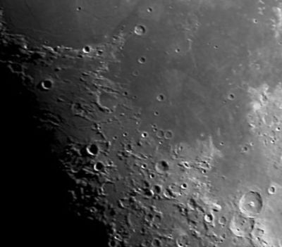
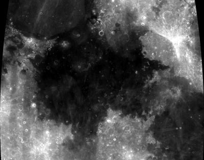
Mare Tranquillitatis
Contents
Tranquillitatis Basin
(unofficial name; IAU feature name for central 873 km of mare: Mare Tranquillitatis)
|
Lat: 8.5°N, Long: 31.4°E, Main ring diam: 700 km, Depth: km, Rükl: 36 |


Left: Eric Soucy, Right: Clementine
Images
LPOD Photo Gallery Lunar Orbiter Images Apollo Images
Ranger 8 - Camera A photographs
Ranger 8 - Camera B photographs
Ranger 8 - Camera P photographs
Maps
(LAC zone 61A4) LAC map Geologic map LTO map
Basin Classification
(description of terms and most numeric basin data from Wood, C.A. (2004) Impact Basin Database)
| Certainty of Existence |
USGS Age |
Wilhelms Age Group |
Ring Diameters |
Mare Thickness |
Mascon |
| Uncertain |
Pre-Nectarian |
3 |
700, 950 km |
1.0 km |
No; -40 mG gravity anomaly |
Description
Description: Wikipedia
Additional Information
- Mare area of 436,000 km^2 according to measurements by Jim Whitford-Stark.
Nomenclature
The IAU feature name means "Sea of Tranquility".
- Called the body of the man in reference to a pre-Galileo telescopic sketch map by Thomas Harriot in ~1609 [Whitaker: Mapping and Naming the Moon, p 17]
- The impact basin is named after the crater.
- Erroneously printed as Mare Tranquilitatis (1 "l") on page 13 (nearside map) in the 21st Century Atlas of the Moon (2012).- DannyCaes Jan 23, 2013
LPOD Articles
Going Extreme An Elusive Phase How Can You Be Tranquil When So Much Is Happening Color on the Cheap Tranquil Sunshine Western Tranquillitatis
Bibliography
Wood, C.A. Aug. 2003. Treasurers of western Tranquillitatis. S&T August 2003 v106 p120