Rima Brayley
Contents
Rima Brayley
|
Lat: 21.4°N, Long: 37.5°W, Length: 311 km, Depth: km, Rükl: 19 |
Table of Contents
[#Rima Brayley Rima Brayley]
[#Rima Brayley-Images Images]
[#Rima Brayley-Maps Maps]
[#Rima Brayley-Description Description]
[#Rima Brayley-Description: Wikipedia Description: Wikipedia]
[#Rima Brayley-Additional Information Additional Information]
[#Rima Brayley-Nomenclature Nomenclature]
[#Rima Brayley-LPOD Articles LPOD Articles]
[#Rima Brayley-Bibliography Bibliography]

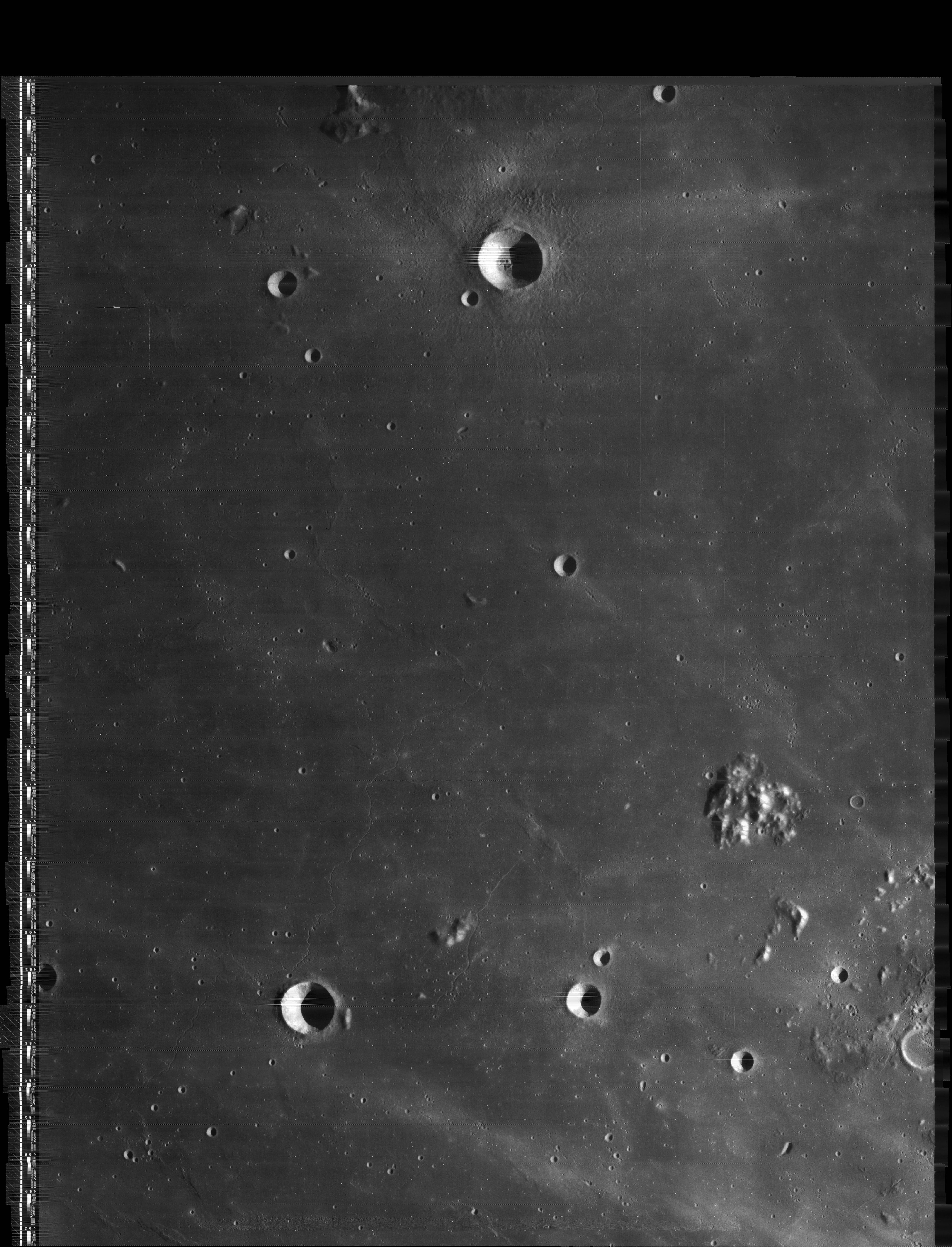
LO-IV-138H The 14-km crater at bottom center is Brayley. A portion of Rima Brayley is faintly visible (click on the image to see a larger version) from upper right to lower left, passing just north and west of Brayley. The rille extends for a considerable additional distance in both directions. Because the IAU name is singular, it is probably not meant to include the much shorter rille by the hill on the right (once known as Brayley Alpha).
High Resolution scan of LO-IV-138-h3
Images
LPOD Photo Gallery Lunar Orbiter Images Apollo Images
Maps
(LAC zone 39C1) LAC map Geologic map LM map LTO map
Description
Description: Wikipedia
Additional Information
Nomenclature
- Named after the nearby crater Brayley
- Number 105 in Debra Hurwitz's Atlas and Catalog of Sinuous Rilles.
- This rille was not named in the original IAU nomenclature of Named Lunar Formations (1935), nor is it depicted on the System of Lunar Craters maps. The present name was provisionally introduced on LTO-39C1 (November 1975), and "approved as assigned" in IAU Transactions XIXB (1985).
LPOD Articles
Bibliography
- The part of Rima Brayley just north of Brayley itself is depicted in APOLLO OVER THE MOON; A VIEW FROM ORBIT, Chapter 6: Sinuous Rimae (Part 2), Figure 198.
This page has been edited 1 times. The last modification was made by - tychocrater tychocrater on Jun 13, 2009 3:24 pm - afx3u2