Sinus Honoris
Contents
Sinus Honoris
|
Lat: 11.7°N, Long: 18.1°E, Diam: 109 km, Depth: km, Rükl: 35 |
Images
LPOD Photo Gallery Lunar Orbiter Images Apollo Images
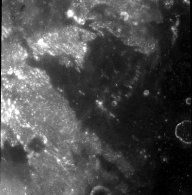
- Orbital Hasselblad photographs AS17-145-22264 and 22265 are two snapshots of Sinus Honoris made during the mission of Apollo 17, december 1972. In the first one of the two photographs, Sinus Honoris is the dark region to the left of the curved horizon's "centre". Looking south, east is upward. In the second photograph, Sinus Honoris is seen above and to the right of the frame's centre. The bright pronounced crater just below the frame's centre is Menelaus.
- Apollo 15's Fairchild camera photograph AS15-M-2698 shows Sinus Honoris and the bright retro-reflection of the sun immediately north of it.
- Research Apollo photographs: Danny Caes
Maps
(LAC zone 60A3) LAC map Geologic map LM map
Description
Description: Wikipedia
Additional Information: the high-albedo craterlet northwest of Sinus Honoris
- The extremely bright ray-craterlet at the northwestern part of Sinus Honoris (between Menelaus and Julius Caesar) was photographed during the mission of Apollo 15. There's only one color-Hasselblad of this bright craterlet: AS15-93-12678 (Kipp Teague's High-Resolution scan). The black lower half of the photograph is the silhouette of the spacecraft's interior. There are five black-and-white Hasselblads of it too: AS15-92-12545, 12546, 12547, 12548, and 12551. Of these five, image 12548 is a good close-up. This bright craterlet looks very distinct when it is observed during Full Moon, through not-too-powerful telescopes. The appearance of it is almost like a bright white star (a starlike point).
Danny Caes research. - Apollo 15 orbital panoramic ITEK-camera frames which also show this bright craterlet: AS15-P-9896 and AS15-P-9898 (in both frames, the bright craterlet is seen at extreme left). Although unrecognizable, frame AS15-P-9903 shows it too. Danny Caes research.
- To see Danny's bright-ray craterlet in Map-a-Planet click here (or on the thumbnail). The Lunar Orbiter view, which appears in LO-IV-090-H2 shows this to be a 1-km diameter crater with a bright ejecta blanket 3-4 km in diameter. The crater is a control point in the 1994 Unified Lunar Control Network, where it is described as "SW of Menelaus D" and its coordinates are given as 13.05°N/15.85°E. - JimMosher
- Those who want to see a real close-up of this bright raycraterlet's interior (its inner slopes and floor with boulders and rocks) should add the pinpoint coordinates LON: 15.87, LAT: 13.042 (2 M/PIX) at the lower margin of the LRO's ACT-REACT Quick Map, and hit the RECENTER button. - DannyCaes Jun 12, 2011
- Or... try the shortlink http://bit.ly/2ovOEGq (an LROC's "Full Moon" view, shows the brightness of this craterlet and its ejectablanket).
Nomenclature
- Sinus Honoris is Latin for "Bay of Honor".
- According to Whitaker this was not one of Riccioli's names. Who did introduce it is unclear. - JimMosher
- Facula Caes (an unofficial name from Danny Caes for the High-Albedo craterlet northwest of Sinus Honoris). D.Caes also want to call this bright craterlet E.Caes, because that was the brother of Danny's father (Emiel Leon Caes, 1936-1998). E.Caes was one of the three persons in Danny's youth who were the sources of Danny's lifelong moon-and-spaceflight adoration. Back in the mid sixties, when Danny was a very young kid, all three together (his father, the brother of his father, and his uncle) made experimental home movies of manned lunar landings, lunar bases, and all things spaceflight-related. The most inspiring of the three was E.Caes. --- I must search another bright craterlet to call it L.Duward (Leonard Duward), because he was my uncle. There's already an Albert at the site of Lunokhod 1, south of Sinus Iridum (Albert Caes; the father of D.Caes). - DannyCaes Feb 25, 2018
Michel Florent Van Langren's TERRA HONORIS near the lunar northpole
- There was already a TERRA HONORIS at the most northern section of Van Langren's map (1645). It was called Regio Hyperborea on J.Hewelcke's map of 1647. Riccioli called this section Terra Siccitatis, as it is seen on the map of Grimaldi from 1651 (immediately north of both Sinus Roris and Mare Frigoris). - DannyCaes Jan 22, 2016
LPOD Articles
Crater Rings, Spots, and Rays during Full Moon (image by Dave Storey).
Bibliography

