Sabine
Contents
[hide]Sabine (of the Ritter-Sabine pair)
|
Lat: 1.4°N, Long: 20.1°E, Diam: 30 km, Depth: 1.4 km, Rükl: 35 |


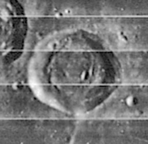
Left: LOIV-085-h1 (shows Sabine and NASA's small bowl-shaped Dark Crater immediately southeast of it, with Ritter west-northwest of Sabine).
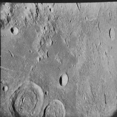
Right: Apollo AS-10-32-4760 (this south-up view shows twin craters Sabine and Ritter, with the bowl-shaped Schmidt nearby).
Images
LPOD Photo Gallery Lunar Orbiter Images Apollo Images
Ranger 8 - Camera A photographs
Superb Apollo 11 oblique view (AS11-41-6121, which is reproduced on pages 200-201 of Norman Mailer's splendid book MOONFIRE, THE EPIC JOURNEY OF APOLLO 11).
Maps
(LAC zone 60C4) LAC map Geologic map LM map AIC map
USGS Geologic Map of the Sabine DM region (I-594) The region a little bit northward of 2° North/ 24° East.
USGS Geologic Map of the Sabine D region (I-618) The Surveyor 5 / Apollo 11 region.
USGS Geologic Map of Apollo Landing Site 2 (Apollo 11)(I-619) Part of the Sabine D region.
USGS Geologic Map of the Sabine EB region (I-679) The region between 2°38'00" North and 2°42'48" North/ 24°30'07" East and 24°36'07" East (the Ranger 8 region).
Additional research: Danny Caes
Description
Description: Elger
(IAU Directions) SABINE.--The more easterly of a remarkable pair of ring-plains, of which Ritter is the other member, situated on the W. side of the Mare Tranquillitatis a little N. of the lunar equator. It is about 18 miles in diameter, and has a low continuous border, which includes a central mountain on a bright floor. From a mountain arm extending from the S. wall, run in a easterly direction two nearly parallel clefts skirting the edge of the Mare. The more southerly of these terminates near a depression on a rocky headland projecting from the coast-line, and the other stops a few miles short of this. A third cleft, commencing at a point N.W. of the headland, runs in the same direction up to a small crater near the N. end of another cape-like projection. At 8 h. on April 9, 1886, when the morning terminator bisected Sabine, I traced it still farther in the same direction. All these clefts exhibit considerable variations in width, but become narrower as they proceed eastwards.
Description: Wikipedia
Additional Information
Depth data from Kurt Fisher database
- Pike, 1976: 1.4 km
- Westfall, 2000: 1.4 km
- Viscardy, 1985: 1.5 km
- Cherrington, 1969: 1.4 km
Nomenclature
- Sir Edward Sabine KCB FRS (October 14, 1788 – May 26, 1883) was an Irish astronomer, scientist, ornithologist and explorer.
- Related material on other features named after Irish scientists.
- Dark Crater (NASA-related nickname for the officially unnamed bowl-shaped crater immediately southeast of Sabine) (this Dark Crater was one of the signposts during the early equatorial missions of the Apollo Program) (see also the nomenclature overlay of the LROC Act-React Quick Map) (seems to have been known as Sabine AD on SLC-chart B5) (System of Lunar Craters) (received no letter designation on Chart 58 in the Times Atlas of the Moon).
LPOD Articles
Lunar 100
L38: Sabine & Ritter; Possible twin impacts
Bibliography
Wood, C.A. 7/2006. False Volcanoes on the Moon. S&T 112:(1):66-67
  Wood, C.A. Aug. 2003. Treasures of the Western Tranquillitatis. S&T 8/2003:120
  A Portfolio of Lunar Drawings (Harold Hill), pages 6, 7.