Rima Jansen
Contents
[hide]Rima Jansen
|
Lat: 14.5°N, Long: 29.0°E, Length: 35 km, Depth: km, Rükl: 25 |
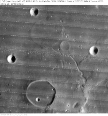
LO-IV-078H Rima Jansen is the groove running southwestward from the center of this view. Jansen is the dark-floored crater near the bottom, and the triangle of circular 7-km craters in the upper half is Jansen E (left), Jansen L (right), and Jansen D (top). To the lower right of Jansen D is the 25-km diameter pancake of Jansen R. The smaller (~8-km) circle to its southwest is unnamed.
Images
LPOD Photo Gallery Lunar Orbiter Images Apollo Images
Maps
(LAC zone 60B2) LAC map Geologic map LM map LTO map
Description
Description: Wikipedia
Additional Information
Nomenclature
Named from nearby crater Jansen
  Number 154 in Debra Hurwitz's Atlas and Catalog of Sinuous Rilles.
LPOD Articles
Bibliography
