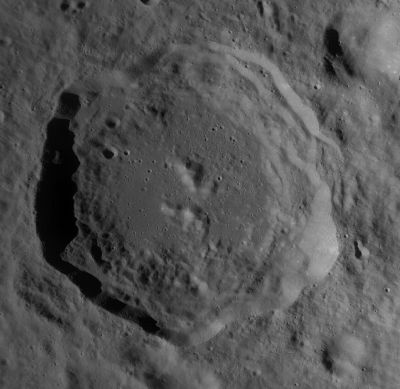
Cantor
Contents
[hide]Cantor
| Lat: 37.98°N, Long: 118.5°E, Diam: 75.72 km, Depth: km, Rükl: (farside) | |
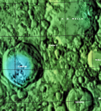
Right: Colo-coded Lac 30 from USGS Digital Atlas//
Images
LPOD Photo Gallery Lunar Orbiter Images Apollo Images Clementine
Cantor was also captured near the lower right corner of Apollo 16's Fairchild-camera photograph AS16-M-3002, which was made during Trans Earth Coast (TEC).
Research: Danny Caes
Maps
(LAC zone 30C1) USGS Digital Atlas PDF
Description
Cantor is a crater of the Late Imbrium period (3.85 to 3.74 bn years), and lies some 800 kilometres away from Mare Humboltianum to the north-west and, roughly, the same distance from Mare Moscoviense to the east -- both Nectarian (3.92 to 3.85 bn years) in age The crater's appearance looks relatively young with its sharp-ish rims, but overall its shape is more oval, or hexagonal, than your average round-looking crater -- due, no doubt, to the result of extended terracing effects in the north-south (less in the east-west) direction. The floor of Cantor has been altered into a series of hills and rises due to these events; with the central regions predominantly showing a broken set of peaks dis-conjoined.- JohnMoore2 JohnMoore2
Wikipedia
Additional Information
- IAU page: Cantor
- Central peak composition: Anorthosite & GNTA1 (Tompkins & Pieters, 1999)
Nomenclature
- Georg; German mathematician (1845-1918)
- Moritz; German mathematician (1829-1920).
LROC Articles
LPOD Articles
Bibliography
Named Features -- Prev: Cannon -- Next: Capella

