Watts
Contents
Watts
(formerly Taruntius D)
|
Lat: 8.83°N, Long: 46.3°E, Diam: 15.55 km, Depth: 0.97 km, Rükl: 37 |
Table of Contents
[#Watts Watts]
[#Watts-Images Images]
[#Watts-Maps Maps]
[#Watts-Description Description]
[#Watts-Description-Wikipedia Wikipedia]
[#Watts-Additional Information Additional Information]
[#Watts-Nomenclature Nomenclature]
[#Watts-LPOD Articles LPOD Articles]
[#Watts-Bibliography Bibliography]

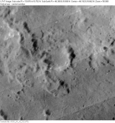
LO-IV-191H Watts is the small formation in the center.
Images
LPOD Photo Gallery Lunar Orbiter Images Apollo Images
Maps
(LAC zone 61B3) LAC map Geologic map LTO map
Description
Wikipedia
Additional Information
- IAU page: Watts
- Depth data from Kurt Fisher database
- Westfall, 2000: 0.97 km
- Viscardy, 1985: 0.9 km
Nomenclature
- Named for Chester Burleigh Watts (1889-1971), an American astronomer who spent many years preparing detailed charts of the topography of the Moon's limb (as seen from Earth).
- This replacement name for a formerly lettered crater was introduced on LTO-61B3 (for which it served as the chart title). It appears in the cumulative list of approved names in IAU Transactions XVB (1973). Since it does not appear in any prior IAU Transactions, it was probably approved at the 1973 meeting. Biographical information was unofficially reported in Ashbrook, 1974. - JimMosher JimMosher
LPOD Articles
Bibliography
Named Featues -- Prev: Watt -- Next: Webb
This page has been edited 1 times. The last modification was made by - tychocrater tychocrater on Jun 13, 2009 3:24 pm - afx3u3