Rükl 61
Contents
Rükl Zone 61 - PIAZZI
Neighboring maps on the Rükl Nearside Map:
Table of Contents
[#Rükl Zone 61 - PIAZZI Rükl Zone 61 - PIAZZI]
[#Rükl Zone 61 - PIAZZI-Photographic Map Photographic Map]
[#Rükl Zone 61 - PIAZZI-Nearside Named Features Nearside Named Features]
[#Rükl Zone 61 - PIAZZI-Farside Named Features Farside Named Features]
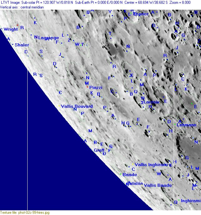
[#Rükl Zone 61 - PIAZZI-Lettered Crater Locations Lettered Crater Locations]
[#Rükl Zone 61 - PIAZZI-Lettered Crater Locations-Full zone with lettered craters Full zone with lettered craters]
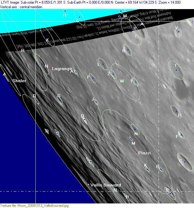
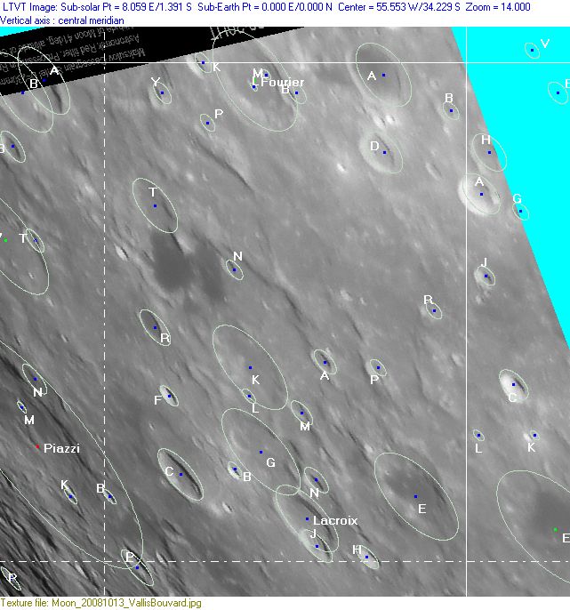
[#Rükl Zone 61 - PIAZZI-Lettered Crater Locations-Lettered craters by quadrants Lettered craters by quadrants]
[#Rükl Zone 61 - PIAZZI-Additional Information Additional Information]
| 61 |
||
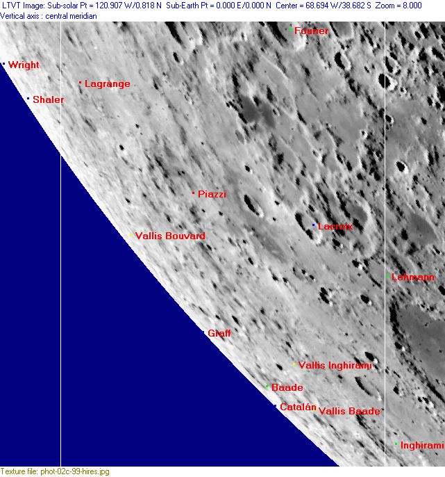
Photographic Map
(This map is based on an Earth-based photograph that has been computer-corrected to zero libration. The vertical white lines indicate the left and right boundaries of the Rükl rectangle)

  Background image source
Nearside Named Features
- Aegyptus (regio) (J.Hewelcke's disallowed name for the southwestern highlands).
- Baade (once called Asaph Hall by J.H.Franz).
- Basaltic Lava Areas (an unofficial name from H.Hill for the low-albedo lakes south of Vieta, north of Lacroix) (also called Honey Lake). The region south of Vieta (between Lehmann and Vieta) seems to be occupied by several rather large unnamed craters (or vaguely observable small impact basins). That's how it looks on SLC map F7.
- Catalán
- Comas Sola (a disallowed name from H.P.Wilkins, probably for H.Hill's Basaltic Lava Areas south of Vieta).
- Fourier (J.Hewelcke's Mons Casius) (note: together with the IAU's Vieta this is the first one of J.Hewelcke's Montes Casius, the second one is the IAU's Agatharchides P).
- Graff
- Illuminated cross near Fourier (a clair-obscur phenomenon discovered by D.Caes, located at approximately 33 degrees South/ 53 degrees West, morning-terminator at 46-47 degrees West).
- Lacroix
- Lacus Fourier (an unofficial name from D.Caes for the low-albedo spot between Fourier and Fourier A) (immediately west of Fourier A).
- Lagrange
- Mons Eos (J.Hewelcke's disallowed name for the bright and dark areas east of Piazzi).
- Morgues (Van Langren's disallowed name for a low-albedo spot near Fourier) (could this have been H.Hill's Basaltic Lava Areas?).
- Piazzi
- Scithiae pars (J.Hewelcke's disallowed name for the southwestern limb area).
- Shaler
- Terra Caloris (Riccioli's discontinued name for the whole of Chart 61).
- Terra Sterilitatis (Riccioli's discontinued name for the southwestern limb region) (which means: Riccioli must have been aware of the phenomenon known as libration) (see also: Farside Features, below).
- Unexpected remains of a possible basin (see this page).
- Vallis Baade
- Vallis Bouvard
- Vallis Inghirami
- Wright
Farside Named Features
(The following features are not formally included in the present Rükl rectangle, but they are adjacent to it and their centers are less than 10° beyond the mean limb -- so they may be seen here in whole or in part with a favorable libration)
- Drude
- Focas
- Guthnick
- Heyrovsky
- Mare Pacificus (an unofficial name, also known as: Orientale Dark Mantle Ring Deposit) (see also Rukl's 50 for the northern part of it).
- Mendel-Rydberg Basin (an unofficial name).
- Rydberg
- Terra Sterilitatis (Riccioli's discontinued name for the southwestern limb region, only visible during favorable libration).
Lettered Crater Locations
(click on the thumbnails to view full-sized images; use browser BACK button to return to this page)
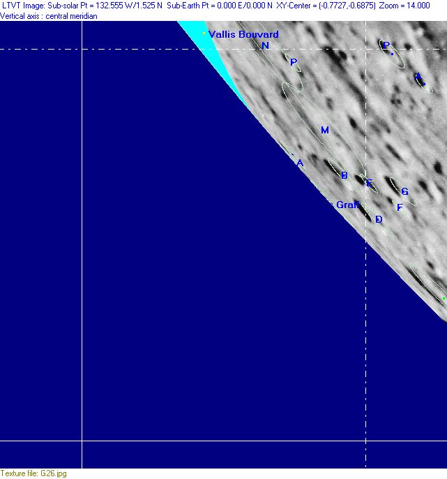
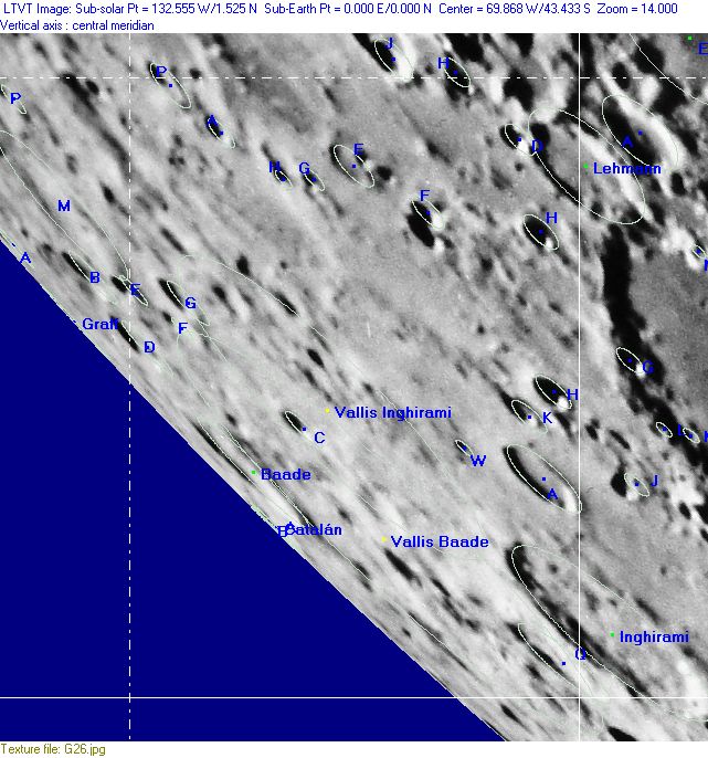
Full zone with lettered craters
Lettered craters by quadrants
(the dashed white lines are the centerlines of the Rükl zones)
| North West |
North East |
| South West |
South East |
Additional Information
- Other online descriptions of features in this Rükl map section:
This page has been edited 1 times. The last modification was made by - tychocrater tychocrater on Jun 13, 2009 3:24 pm - mgx2
