South AP
Contents
South AP (suspected crater south of the Aristarchus Plateau)
(South AP is an informal name)| Lat: 21.4°N, Long: 48.2°W, Diameter: ~110 km, Depth: km, Rükl: 18 |

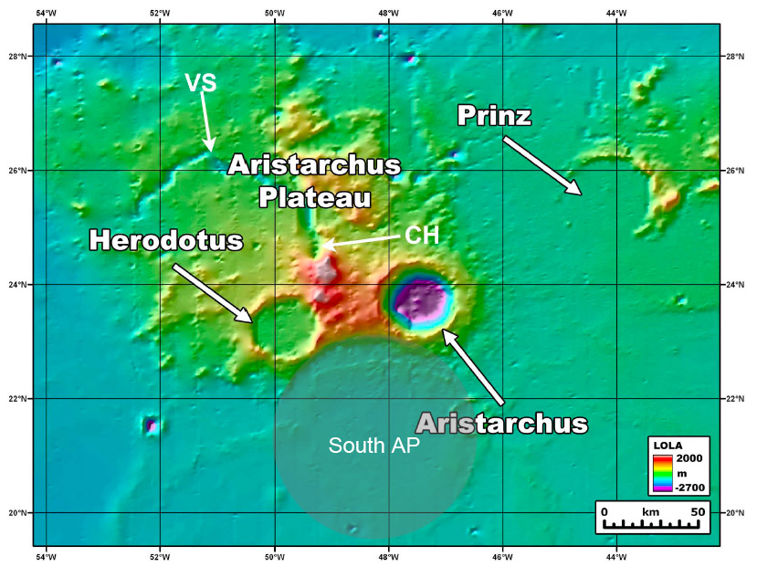
Image from Mustard et al (2011) with added area and name of putative crater added

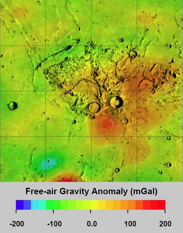
Image from Kiefer (2009)
Images
Maps
(LAC zone xxxx) LAC map Geologic map
Description
"Lunar Orbiter Laser Altimetry (LOLA) altimetry data [Smith et al., 2010] reveal the presence of a remnant heavily degraded ∼110 km diameter unnamed crater that lies just to the south of the Aristarchus Plateau (AP). The rim crest of this crater, informally referred to as the South AP crater, cuts the southern margin of the plateau, forming a broad arch between the southeastern rim of Herodotus and the southwestern rim of Aristarchus. South AP crater is clearly pre‐Imbrian in age, helps to form the distinctive scarp along the southern part of the Aristarchus Plateau, and its rim and ejecta are major contributors to the high topography that defines the high southern rim of the Aristarchus Plateau (Figure 1). Post‐Imbrium basin mare basalts have extensively flooded South AP crater, filling it and embaying the rest of the plateau." [This discription is a quote from Mustard et al, 2011]
Description: Elger
Additional Information
Nomenclature
On the eastern part of the South AP's rim there's the shallow crater Aristarchus F, which was once called MacDonald by H.P.Wilkins and P.Moore.- DannyCaes Sep 16, 2012
LPOD Articles
Bibliography
- Mustard et al (2011) Compositional diversity and geologic insights of the Aristarchus crater from Moon Mineralogy Mapper data. JOURNAL OF GEOPHYSICAL RESEARCH, VOL. 116, E00G12, doi:10.1029/2010JE003726, 2011.
  - Kiefer (2009) Gravity observations of the Aristarchus plateau on the Moon: implications for the volcanic and impact histories of the plateau. 40th Lunar and Planetary Science Conference, 2009