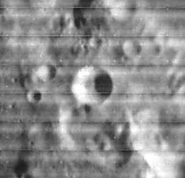
Glaisher
Contents
Glaisher
|
Lat: 13.2°N, Long: 49.5°E, Diam: 15 km, Depth: 3.29 km, Rükl: 37 |
Images
LPOD Photo Gallery Lunar Orbiter Images Apollo Images
Maps
(LAC zone 61B2) LAC map Geologic map LTO map
Description
Description: Wikipedia
Additional Information
Depth data from Kurt Fisher database
- Pike, 1976: 3.29 km
- Westfall, 2000: 3.29 km
- Viscardy, 1985: 2.6 km
- Included on the ALPO list of banded craters
Nomenclature
- James Glaisher was an English meteorologist and aeronaut (April 7, 1809 - February 7, 1903). In 1845, Glaisher published his dew point tables, for the measurement of humidity. Glaisher was a founder member of the Meteorological Society (1850), and the Aeronautical Society of Great Britain (1866). He is most famous, however, as a pioneering balloonist. Between 1862 and 1866, usually with Henry Tracey Coxwell as his co-pilot, Glaisher made numerous ascents in order to measure the temperature and humidity of the atmosphere at its highest levels.
- According to Ewen A. Whitaker's book (see below, bibliography) there should have been a lunar mountain called Mons Glaisher (or Mount Glaisher). This was one of John Lee's new names. Although the I.A.U. did not accept it, it would be very interesting to know the exact coordinates of J.Lee's "Mount Glaisher". Was it near Glaisher itself?
LPOD Articles
Bibliography
John Lee's "Mount Glaisher": MAPPING AND NAMING THE MOON, Ewen A. Whitaker (page 221, Appendix J).
James Glaisher and Luminous Sulphurous Meteors (The Sourcebook Project)
- Report on Observations of Luminous Meteors during the Year 1873-1874 (Report of the British Association, 1874) (Sulphur/ Pollen Falls), see Tornados, Dark Days, Anomalous Precipitation, and related weather phenomena (William R. Corliss, The Sourcebook Project, 1983).
