Dorsum Nicol
Contents
[hide]Dorsum Nicol
|
Lat: 18.0°N, Long: 23.0°E, Length: 50 km, Height: km, Rükl: 24 | |
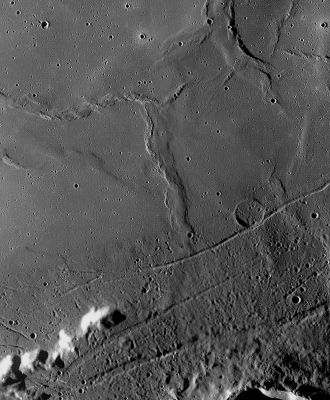
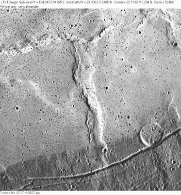
Right: AS17-M-0602 Dorsum Nicol is the prominent north-south ridge in this low Sun view. The ridges to which it connects at the top are regarded as part of the Dorsa Lister system. At the bottom, the grooves are part of Rimae Plinius, crossing (on the right) the 8-km diameter crater Brackett. The band of darkness at the bottom is real, and represents a dramatic difference in the reflectance of the lunar surface in this area at the extreme southern shore of Mare Serenitatis. The band can be traced over a considerable part of the periphery of the Mare.
Images
LPOD Photo Gallery Lunar Orbiter Images Apollo Images
Maps
(LAC zone 42C4) LAC map Geologic map LM map LTO map
Description
Description: Wikipedia
Additional Information
- Dorsum Nicol, Rimae Plinius, Brackett, the northern part of crater Plinius's rim, and Promontorium Archerusia, are depicted on the cover of the album APOLLO: ATMOSPHERES AND SOUNDTRACKS by Brian Eno, Daniel Lanois, and Roger Eno (1982). This orbital handheld Hasselblad photograph (AS17-150-23069) looks great on the L.P.-edition which appeared in the early eighties!
- Detection of Dorsum Nicol and environs on the cover of Eno's Apollo-album: Danny Caes.
Nomenclature
- William; Scottish physicist (1768-1851).
- This name was provisionally introduced on LTO 42C4. It was approved by the IAU in 1976 (IAU Transactions XVIB).
LROC Articles
Bibliography

