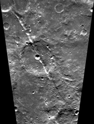
Vallis Schrödinger
Contents
[hide]Vallis Schrödinger
| Lat: 67.0°S, Long: 105.0°E, Length: 310 km, Depth: km, Rükl: (farside) |
Images
LPOD Photo Gallery Lunar Orbiter Images Apollo Images
Maps
(LAC zone 140A1) USGS Digital Atlas PDF
Description
Description: Wikipedia
Additional Information
- East of Schrodinger (between Schrodinger and De Forest, see Clementine's photographs on LAC 141) is an irregular shaped valley of which the most pronounced (and most shadowed) part is located at 165° to 170° East, 77° South.
  Research: Danny Caes
  - Vallis Schrodinger is an eye-catcher on the fantastic globe-shaped (or balloon-shaped) photographic atlas of the moon (Luke Jerram's MUSEUM OF THE MOON).
Nomenclature
- Named from nearby crater. (Schrödinger).
  - Printed as "Rima Schrodinger" on the farside map of Hallwag.
  - The pronounced valley between Schrodinger and De Forest is unofficially called Vallis Schrodinger-De Forest by D.Caes.
LPOD Articles
Bibliography
