Sherlock
Contents
[hide]Sherlock (Apollo 17 site craterlet name)
|
Lat: 20.2°N, Long: 30.8°E, Diam: 0 km, Depth: km, Rükl: 25 |
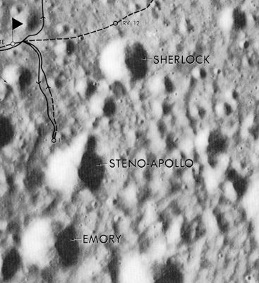
Apollo 17 Site Traverses Chart
Images
LPOD Photo Gallery Lunar Orbiter Images Apollo Images
- AS17-143-21882 shows a peculiar boulder north-northeast of Sherlock, discovered by Gene Cernan and Jack Schmitt while they were en-route from Station 9 to the LM.
- Source: Eric M. Jones's ALSJ (Apollo Lunar Surface Journal).
Maps
(LAC zone 43D1) LAC map Geologic map LTO map
Description
Description: Wikipedia
Sherlock (correct link)
Additional Information
- The Landing Site Name "Sherlock" is plotted on Topophotomap 43D1/S1 and Site Traverses chart 43D1S2.
Nomenclature
- Astronaut-named feature, Apollo 17 site.
- East-northeast of Sherlock is a small crater which seems to have been called Mariner (slightly northward of the landing site of Apollo 17's LM Challenger). Source: APOLLO 17 Preliminary Science Report.- DannyCaes May 6, 2014
LPOD Articles
Bibliography
David M. Harland: EXPLORING THE MOON, the Apollo expeditions.
  Eric M. Jones: APOLLO LUNAR SURFACE JOURNAL (ALSJ).
