Rimae Menelaus
Contents
[hide]Rimae Menelaus
(unofficially known as Fossae Menelaus)
| Lat: 17.2°N, Long: 17.9°E, Length: 131 km, Depth: km, Rükl: 24 |
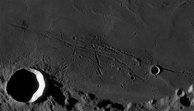
Left: LROC WAC mosaic (No.'s M117379381ME, M117372616ME). Processed by LROC_WAC_Previewer.
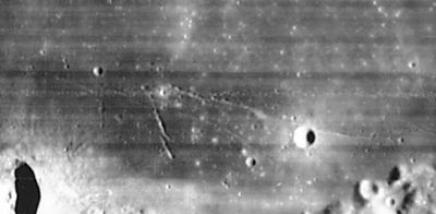
Right: LOIV 090 H2
Images
LPOD Photo Gallery Lunar Orbiter Images Apollo Images
Maps
(LAC zone 42D3) LAC map Geologic map LM map LTO map
Description
Description: Wikipedia
Additional Information
Nomenclature
Named from nearby crater. (Menelaus)
  Unofficially known as Fossae Menelaus, see Lunar Topographic Orthophotomap 42-D3.
  The most western part of Rimae Menelaus/ Fossae Menelaus has a dome called Menelaus Zeta, located north-northwest of Menelaus itself (see Chart 30 in the Times Atlas of the Moon). - DannyCaes Oct 21, 2015
LPOD Articles
An IR strip across a Kipuka
Ancient Island
Bibliography

