Rima Yangel'
Contents
Rima Yangel'
(unofficially known as Fossa Yangel')
|
Lat: 16.7°N, Long: 4.6°E, Length: 30 km, Depth: km, Rükl: 22 | |
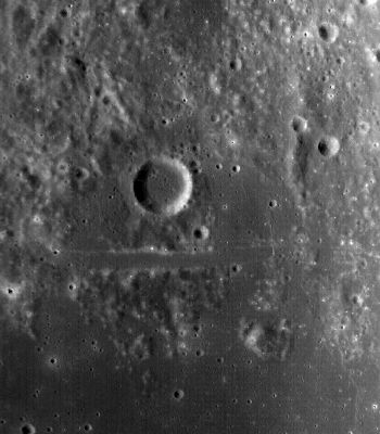
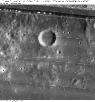
Right: LO-IV-102H Yangel' is the circular crater above center. The 2-km wide Rima Yangel' runs horizontally across the center of the frame below it.
Images
LPOD Photo Gallery Lunar Orbiter Images Apollo Images (for Rima Yangel', see Manilius F, the crater officially known as Yangel').
- Rima Yangel' was also captured on frame AS15-M-2573, made by the southward looking Fairchild camera of Apollo 15 (both crater Yangel' and nearby Rima Yangel' are noticeable slightly rightward of the frame's centre).
- Research Danny Caes
Maps
(LAC zone 41C4) LAC map Geologic mapLM map LTO map
Description
Description: Wikipedia
Additional Information
High Albedo ray-craterlet near (or south of) the western part of Rima Yangel'. A good test object for telescopic observers of the Full Moon.- DannyCaes Jun 9, 2012
Nomenclature
Named from nearby crater. (Yangel')
  Unofficially known as Fossa Yangel' on Lunar Topographic Orthophotomap 41-C4.
LPOD Articles
Bibliography

