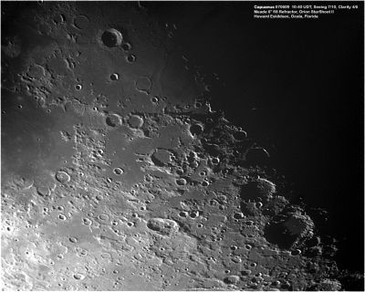
Palus Epidemiarum
Contents
Palus Epidemiarum
|
Lat: 32.0°S, Long: 28.2°W, Diam: 286 km, Depth: km, Rükl: 63 |
Images
LPOD Photo Gallery Lunar Orbiter Images Apollo Images
Maps
(LAC zone 94D4) LAC map Geologic map
Description
Description: Wikipedia
Additional Information
Mare area of 21,150 km² according to measurements by Jim Whitford-Stark.
Nomenclature
- "Marsh of Epidemics".
- Palus Epidemiarum was once called the Bluereed meadow. This name (or nickname) appeared on a moonmap which was included in the LPOD of February 11, 2004.
LPOD Articles
Look Ma. No lines Grand Central Station Marsh of Epidemics
Bibliography
A Portfolio of Lunar Drawings (Harold Hill), pages 154, 155.
