Lacus Solitudinis
Contents
[hide]Lacus Solitudinis, immediately south of Bowditch
| Lat: 27.8°S, Long: 104.3°E, Diam: 139 km, Depth: km, Rükl: (farside) |


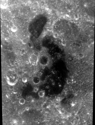
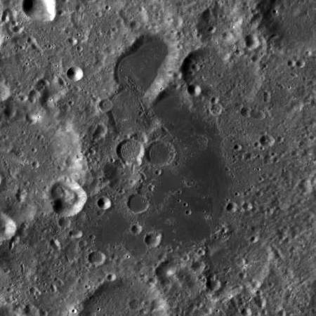
left: //Clementine. right: LROC . Lacus Solitudinis is the concave dark formation at center of image. Bowditch crater at top
Images
LPOD Photo Gallery Lunar Orbiter Images Apollo Images ASU Apollo Image Archive
- Apollo 8's orbital Hasselblad AS08-12-2195 shows a rather distant view of Lacus Solitudinis and adjacent crater Bowditch.
- Apollo 15's oblique south-looking orbital Fairchild metric/mapping camera frame AS15-M-2498 shows much of Lacus Solitudinis's southern half at the foreground (the dark region nearby).
- Lacus Solitudinis is also recognizable in the series of TEC-photographs made during Apollo 17 (A17 Revolution TE).
- Research orbital Apollo photography: Danny Caes
Maps
Description
Description: Wikipedia
Additional Information
- Lacus Solitudinis and nearby crater Bowditch are described and depicted in APOLLO OVER THE MOON: A VIEW FROM ORBIT, Chapter 7: Unusual Features (Part 1), Figure 230.
Nomenclature
- "Lake of Solitude".
- The name Lacus Solitudinis sounds a bit like Palus Solitatis, which could have been the official name of the low-albedo region near crater Andersson, at centre of the Mendel-Rydberg Basin. Unfortunately, this name was not approved by the IAU. See page Luna Incognita.
LPOD Articles
Bibliography