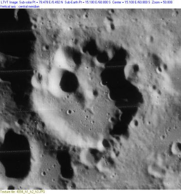
Kinau
Contents
Kinau
|
Lat: 60.8°S, Long: 15.1°E, Diam: 41 km, Depth: 2.12 km, Rükl: 74 |
Images
LPOD Photo Gallery Lunar Orbiter Images Apollo Images
Maps
(LAC zone 127D4) LAC map Geologic map
Description
Description: Elger
(IAU Directions) KINAU.--One of the group of remarkable ring-plains extending in a N.E. direction from Pentland.
Description: Wikipedia
Additional Information
- Depth data from Kurt Fisher database
- Westfall, 2000: 2.12 km
- Viscardy, 1985: 2 km
- According to LTVT, the shadows in LO-IV-094H correspond of height differences of up to 2,360 m. - Jim Mosher
Nomenclature
- Named for Adolph (or Adolf) Gottfried Kinau (January 4, 1814 - January 9, 1888), a German Protestant minister and astronomer. Kinau was known as selenographer who had specialized in lunar rills. In 1847 he discovered six lunar rills and continued to make lunar drawings all his life.
- Attributed to botanist C.A. Kinau in Who's Who in the Moon. Correct honoree discovered by Robert Garfinkle and B. Pfeiffer.
LPOD Articles
Bibliography
- Garfinkle, R. A.; Pfeiffer, B. 2007. Discovery of the real person behind the name of the lunar crater Kinau. Journal of the British Astronomical Association, vol.117, no.2, p.81-84.
