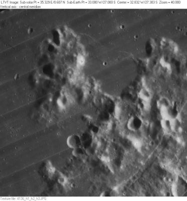
Kelvin, Prom.
Contents
Promontorium Kelvin
(formerly Cape Kelvin)
|
Lat: 27.0°S, Long: 33.0°W, Diam: 50 km, Depth: 1.88 km, Rükl: 52 |

Images
LPOD Photo Gallery Lunar Orbiter Images Apollo Images
Maps
(LAC zone 93C2) LAC map Geologic map
Description
Description: Wikipedia
Additional Information
Depth data from Kurt Fisher database
- Cherrington, 1969: 1.88 km
Nomenclature
William Thomson, Lord Kelvin (June 26, 1824 – December 17, 1907) was an Irish mathematical physicist, engineer, and outstanding leader in the physical sciences of the 19th century. He did important work in the mathematical analysis of electricity and thermodynamics, and did much to unify the emerging discipline of physics in its modern form. He is widely known for developing the Kelvin scale of absolute temperature measurement. He also had a second career as a telegraph engineer and inventor, a career that propelled him into the public eye and ensured his wealth, fame and honour.
LPOD Articles
Bibliography