Grissom-White Basin
Contents
[hide]Grissom-White Basin
(unofficial name)| Lat: 44°S, Long: 161°W, Main ring diam: 600 km, Depth: km, Rukl: farside |
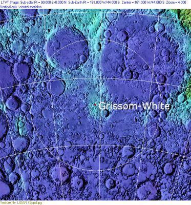
Clementine, Clementine LIDAR Altimeter texture from PDS Map-a-Planet remapped to north-up aerial view by LTVT. The dot is the center position and the white circle the main ring position from Chuck Wood's Impact Basin Database. Grid spacing = 10 degrees.
Images
LPOD Photo Gallery Lunar Orbiter Images Apollo Images
Maps
(LAC zone 120C3)
Basin Classification
(description of terms and most numeric basin data from Wood, C.A. (2004) Impact Basin Database)
| Certainty of Existence |
USGS Age |
Wilhelms Age Group |
Ring Diameters |
Mare Thickness |
Mascon |
| Uncertain |
Pre-Nectarian |
2 |
600 km ? |
Description
Additional Information
Nomenclature
Basins filled with maria are named for the mare, and basins that were previously recognized as craters still bear the crater name. Basins located between craters have the names of the two opposite craters with a hyphen in between, in this case Grissom and White.
LPOD Articles
Bibliography
