De Forest
Contents
[hide]De Forest
|
Lat: 77.3°S, Long: 162.1°W, Diam: 57 km, Depth: km, Rükl: (farside), Upper Imbrian |


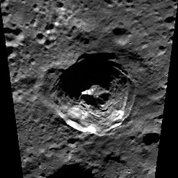
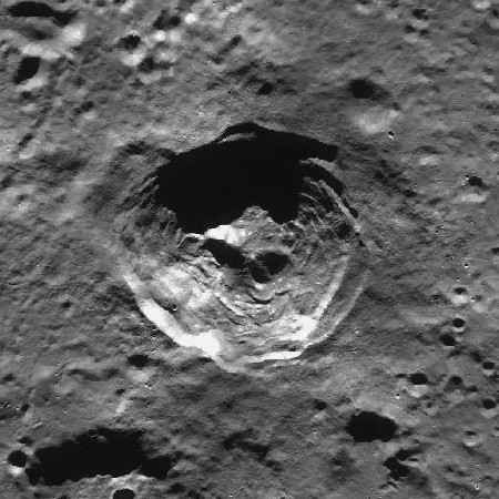
left: Clementine . right:''LROC . De Forest is located on the southern farside, west of Zeeman and south of Antoniadi .
Images
LPOD Photo Gallery Lunar Orbiter Images
Maps
(LAC zone 142D4) USGS Digital Atlas PDF
Description
Description: Wikipedia
Additional Information
- The northern part of crater De Forest's dark shadowed floor and pronounced central peak look impressive on LAC 142 of Ben Bussey's and Paul Spudis's Clementine Atlas of the Moon (page 284). - DannyCaes May 12, 2009
- West of De Forest (between De Forest and Schrödinger-- see Clementine's photographs at LAC 141 -- is an irregular shaped valley of which the most pronounced (and most shadowed) part is located at 165° to 170° East, 77° South.
- See LO IV-008-M (which also shows the Amundsen-Ganswindt basin near Schrödinger!). Research: Danny Caes
200 meter diameter boulder on the southern inner slopes of De Forest
The coordinates of this boulder are: LAT -77.537 / LON -161.86
Nomenclature
- Named for Lee De Forest (1873-1961), an American inventor.
- The pronounced valley between De Forest and Schrödinger is unofficially called Vallis De Forest-Schrödinger (or Vallis Schrödinger-De Forest) by D.Caes.
LPOD Articles
Bibliography