Cone
Contents
[hide]Cone (Apollo 14 site craterlet name)
|
Lat: 3.7°S, Long: 17.4°W, Diam: 0.3 km, Depth: 0.085 km, Rükl: 42 | |
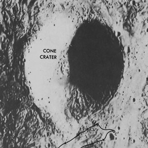
Left: Apollo 14 Site Traverses Chart
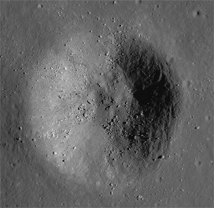
Right: Deconvolved and enhanced image by NASA/GSFC/ASU/GoneToPlaid – Homepage
Images
LPOD Photo Gallery Lunar Orbiter Images Apollo Images
Mike Constantine's assembled panorama of Apollo 14's LM Antares shows the distant slopes of Cone' crater (behind the LM, in east-northeast direction). The bright spot at the top of LM Antaress Ascent Stage is the partially obscured sun (not a reflection, as mentioned above Mike's pan).
Saddle rock
A small cluster of boulders immediately south-southeast of Cone crater was a perfect subject for one of Edgar Mitchell's photographic panoramas. One of the cluster's boulders was called Saddle rock because of its distinct shape. Boulder cluster with Saddle rock
  Source: APOLLO LUNAR SURFACE JOURNAL (ALSJ, Eric M. Jones).
Maps
(LAC zone 76B1) LAC map Geologic map LM map AIC map
Description
Sampling the ejecta blanket on the slopes of Cone crater, thought to include an excavated version of material scattered by the Imbrium impact event, was one of the major objectives of the Apollo 14 mission, and one that was accomplished. The astronauts also hoped to look into the crater, but navigating on the lunar surface proved much harder than anticipated, and despite their best efforts the astronauts were never able to locate or look over the rim. The post-flight plot of their track suggest they may have come with as little as 50 feet of the overlook as they turned back towards the Lunar Module.
Description Wikipedia
(no Wikipedia page for Apollo 14's Cone crater, but... Cone is mentioned in the page Fra Mauro Formation).
Additional Information
- The coordinates given in the title line are from Davies and Colvin and were estimated, by them, based on the offset from the known position (in the Mean Earth/Polar system) of the Apollo 14 ALSEP package near Doublet crater. The depth and diameter are LTVT measurements on Lunar Orbiter image LO-III-133H. Most NASA reports give the diameter as either 340 or 370 m. Davies and Colvin say it is 375 m. The official data from the IAU Planetary Gazetteer are: Lat: 3.7°S, Long: 17.4°W, Diam: 0 km. The LTVT depth measurement is for a shadow from the east rim, similar to the one shown in the Apollo 14 Site Traverses Chart, and agrees reasonably well with a USGS Contour Map (4.1 MB). That map suggests that the shadow was passing over one of the steepest sections, and the depth to the northeast may be as little as 25 meters.
- IAU page: Cone
Nomenclature
Astronaut-named feature, Apollo 14 site.
LPOD Articles
Bibliography
- Alice J. Hall: APOLLO 14; the climb up Cone crater (National Geographic, July 1971).
  - David M. Harland: EXPLORING THE MOON, the Apollo expeditions.
  - Eric M. Jones: APOLLO LUNAR SURFACE JOURNAL (ALSJ).
Named Features -- Prev: Condorcet -- Next: Congreve

