Autolycus
Contents
Autolycus
|
Lat: 30.7°N, Long: 1.5°E, Diam: 39 km, Depth: 3.43 km, Rükl: 12, Eratosthenian |

Howard Eskildsen,
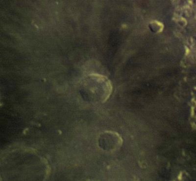
Telescopic view of the Palus Nebularum and Sinus Lunicus regions (the eastern part of Mare Imbrium). Crater Autolycus is just below center of the frame, south of the much more prominent crater Aristillus. The much larger crater Archimedes is noticeable in the lower left corner of the frame. Crater Theaetetus is seen near the upper right corner. The row of mountains near the right margin of the frame are the Montes Caucasus.
Images
LPOD Photo Gallery Lunar Orbiter Images Apollo Images
Maps
(LAC zone 41B1) LAC map Geologic map LM map
Description
Description: Elger
(IAU Directions) AUTOLYCUS.--A ring-plain 23 miles in diameter, deviating considerably from circularity, E. of Archimedes, on the Mare Imbrium, or rather on that part of it termed the Palus Putredinis. Its floor, which contains an inconspicuous central mountain, is depressed some 4,000 feet below the surrounding country. With a power of 150 on a 4 5/8 achromatic, Dr. Sheldon of Macclesfield has seen two shallow crateriform depressions in the interior, one nearly central, and the other about midway between it and the N. wall. The wall is terraced within, and has a crater just below its crest on the E., which, when the opposite border is on the morning terminator, is seen as a distinct notch. Autolycus is the centre of a minor ray-system.
Description: Wikipedia
Additional Information
- Depth data from Kurt Fisher database
- Westfall, 2000: 3.43 km
- Viscardy, 1985: 3.43 km
- Depth data from (Boint 2001. Thesis. Augustana College, Sioux Falls, SD): 3.56 km.- fatastronomer
- Originally mapped as Copernican because has rays but these are compositional rays (highlands material) that have reached full optical maturity and thus it is older than Copernicus and is Eratosthenian age. Hawke et al Composition and origin of Coprnican Rays… Mappers Conference 2005.
- Included in ALPO list of bright ray craters.
Nomenclature
Autolycus of Pitane (ca. 360 BC—d. ca. 290 BC) was a Greek astronomer, mathematician, and geographer. Autolycus' surviving works include a book on spheres (called On the Moving Sphere) and another on the rising and setting of celestial bodies.
Several hills near Autolycus received Greek letter designations. They are seen on the charts of the System of Lunar Craters (1966).
Autolycus Alpha: south-southwest of Autolycus.
Autolycus Beta: south-southeast of Autolycus.
Autolycus Gamma: southeast of Autolycus, north-northeast of Autolycus Beta.
(both of them, Beta and Gamma, are prominent clusters of hills located west of Promontorium Fresnel and Rimae Fresnel) (they were very well captured on the orbital northward looking Fairchild photographs made during the mission of Apollo 15 in 1971).
Autolycus Eta: west of Autolycus.
Autolycus Omega: east of Autolycus.
Autolycus B ?
Charts SLC C2, SLC D2, SLC C3, and SLC D3 (System of Lunar Craters, 1966) show a certain surface formation called "Autolycus B" immediately south of Autolycus. This "Autolycus B" is not seen on chart 18 in the Times Atlas of the Moon. Even the nomenclature overlay of the online LROC ACT-REACT Quick Map doesn't show an "Autolycus B". Do I have to look a bit further in NASA's pre- and post-Apollo maps to see the true location of Autolycus B? - DannyCaes Apr 2, 2017
  No Autolycus B on the LAC 41 map...
  No Autolycus B on the geologic map...
  According to most sources, there's only Autolycus A on the eastern part of the rim of Autolycus, and Autolycus K near the southern end of Montes Caucasus.
LPOD Articles
Three Cheers for Three As A and A
Bibliography