Anuchin
Contents
Anuchin
| Lat: 49.0°S, Long: 101.3°E, Diam: 57 km, Depth: km, Rükl: (farside) |


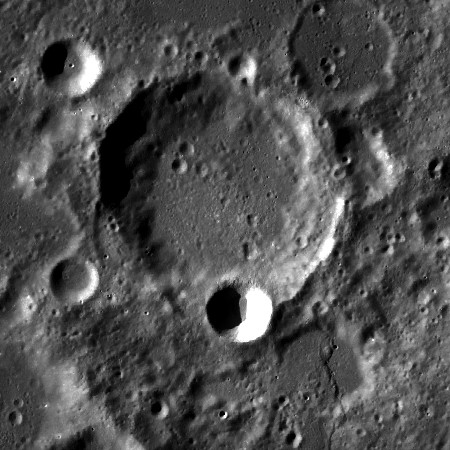
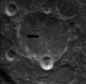
left: LROC . Note at lower right of Anuchin the lobate scarp that runs south to Kugler
right: Clementine The bright 15-km diameter crater on Anuchin's south rim is Anuchin L. The similar crater in the upper left corner is Anuchin V.
Images
LPOD Photo Gallery Lunar Orbiter Images
Anuchin was also captured near the upper margin of Lunar Orbiter 4's frame LOIV-011-h1.
Research: Danny Caes (thanks to Patricio Leon (Nunki) who's a dedicated observer of the nearby mountain Mons Cassegrain).
Maps
(LAC zone 130A1) USGS Digital Atlas PDF
Description
Description: Wikipedia
Additional Information
Nomenclature
- Named for Dimitrii Nikolaevich Anuchin(1843-1923), a Russian geographer.
- Anuchin was in a bank of 195 names of scientists approved by the IAU in 1976 for future use on the Moon (IAU Transactions XVIB). Three years later it was among "54 names, approved as assigned to features on the lunar surface" (IAU Transactions XVIIB). This is usually a reference to the name appearing on one of the maps prepared for NASA by the DMA. However, it is unclear what map is being referred to here. The on-line IAU Planetary Gazetteer gives LMP-3 as the official map reference. Although the crater is depicted on that map (prepared in October 1970), it was not named there.
LPOD Articles
Bibliography