Palus Nebularum
Contents
Palus Nebularum
(discontinued IAU name)
|
Lat: 38.5°N, Long: 4.8°E, Diameter: 80 km, Depth: km, [/Rukl%2012 Rukl: 12] |


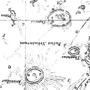
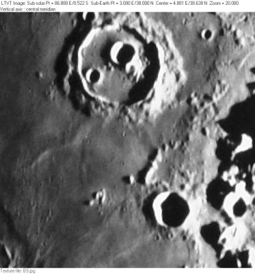
Left: extract from Neison’s Map 3 (rotated to north up); Right: Consolidated Lunar Atlas Plate B9 The multi-part crater at the top of the frame is [/Cassini Cassini]. The smaller deeply shadowed one near the bottom is [/Theaetetus Theaetetus]. The name "Palus Nebularum" apparently referred to the long, pointed section of mare between them; just south of [/Cassini Cassini]; but to some it may have extended farther because Elger refers to [/Theaetetus Theaetetus] as lying within it. Possibly it refers to the entire ring of mare around [/Cassini Cassini].
Table of Contents
Images
LPOD Photo Gallery Lunar Orbiter Images (see list for nearby crater Cassini)
Maps
([/LAC%20zone LAC zone] 25C2) LAC map Geologic map
Description
[/Neison%2C%201876 Neison, 1876] (p. 182) describes Palus Nebularum as “a level plain without any natural boundary on the south and east.” In place of a natural boundary, he suggests it should be regarded as extending to an imaginary line drawn from [/Theaetetus Theaetetus] to [/Aristillus Aristillus] and from there to [/Mons%20Piton Mons Piton] and then to Cassini Eta, a peak to the NW of [/Cassini Cassini] (at the top of the extract from his map). Presumably Neison regarded it as including all the mare area to the north and east of [/Cassini Cassini], but he is not clear about that.
Additional Information
Nomenclature
- "Marsh of Mists"
- The name "Palus Nebularum" appears in Mary Blagg's [/Collated%20List Collated List] (1913), where it was used by all three of her authorities, and it was part of the original IAU nomenclature of [/Blagg%20and%20M%C3%BCller Blagg and Müller] (1935). The name was deleted by Kuiper et al., whose changes to Blagg and Müller (published in the [/PLA%20Table%20III Photographic Lunar Atlas]) were approved by the IAU in 1961.
- Despite the IAU approval, the name can be found on some post-1961 maps, such as the one in [/Baldwin Baldwin] (1963).
- This backwater of [/Mare%20Imbrium Mare Imbrium] does not presently have a separate name. - JimMosher JimMosher
LPOD Articles
Bibliography
This page has been edited 1 times. The last modification was made by - tychocrater tychocrater on Jun 13, 2009 3:24 pm - mfx3