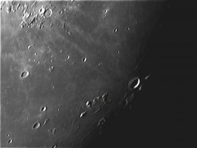
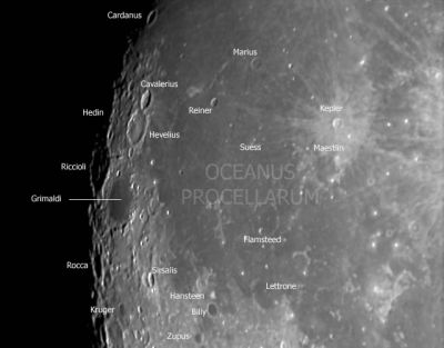
Oceanus Procellarum
Contents
[hide]Oceanus Procellarum
|
Lat: 20.67°N, Long: 56.68°W, Diam: 2592.24,568 km, Depth: km, Rükl: 18 |


Left: Dave Storey, The Isle of Man Observatory, Right: Eric Soucy
Images
LPOD Photo Gallery Lunar Orbiter Images Apollo Images
Trivia
AS09-23-3500 is a curious NASA-photograph which shows the Last Quarter Moon, made by the crew of Apollo 9 (an Earth-orbiting mission to test the capabilities of the first Lunar Module in space)(LM Spider). The photograph shows all of Oceanus Procellarum. Research: Danny Caes.
Maps
(LAC zone 38C4) LAC map Geologic map LM map
Description
Wikipedia
Additional Information
- IAU page: Oceanus Procellarum
- Area of 1,692,000 km^2 according to measurements by Jim Whitford-Stark.
- Oceanus Procellarum has sometimes been associated with the Procellarum Basin, a proposed vast ancient impact feature, of uncertain existence, covering most of the Moon's nearside. - JimMosher
Nomenclature
- "Ocean of Storms".
- Central and northern part named Insula Longa (Long Island) in pre-telescopic sketch map by William Gilbert in ~1600 [Whitaker: Mapping and Naming the Moon, p 15]
- Called Eoum Mare (Eastern Sea) by Gassendi in late 1630s [Whitaker: Mapping and Naming the Moon, p 33].
- Called Oceanus Philippicus by Van Langren (Langrenus). See: Whitaker, Mapping and Naming the Moon, p 198.
LROC Articles
LPOD Articles
- 3-D Ball (Kaguya's Bass-Relief look at the moon's western hemisphere and Oceanus Procellarum).
APOD articles
- Oceanus Procellarum, noticeable on the moon's silhouette in a Detailed View of a Solar Eclipse Corona
Lunar 100
- L95: The Moon's biggest basin?
Bibliography
- Nakamura, R. et al (2012). Compositional evidence for an impact origin of the Moon’s Procellarum basin – Nature Geoscience, Vol 5, No 10, DOI:10.1038/ngeo1614. Published 28 Oct, 2012.
Named Features -- Prev: Priscilla -- Next: Proclus