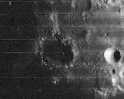
Lyell
Contents
Lyell
| Lat: 13.6°N, Long: 40.6°E, Diam: 32 km, Depth: 2.56 km, Rükl: 36 |
Images
LPOD Photo Gallery Lunar Orbiter Images Apollo Images
- Apollo 17's orbital color Hasselblad photograph AS17-145-22263 is a southward looking view over Sinus Concordiae (above centre) and Lyell in Palus Somni (Lyell is the dark crater a little below and right of centre).
- Apollo 17's B-and-W Hasselblad AS17-154-23600 shows Lyell near the frame's upper margin, looking southward.
- Research Danny Caes
Maps
(LAC zone 61B1) LAC map Geologic map LTO map
Description
Description: Wikipedia
Additional Information
Depth data from Kurt Fisher database
- Westfall, 2000: 2.56 km
- Cherrington, 1969: 1.49 km
When Lyell A (called Abduh on LTO map 61-A2) is observed near or during Full Moon, it (Lyell A) looks very much like a typical "ring nebula" (a planetary nebula). Figure 51 in NASA SP-362 APOLLO OVER THE MOON, Chapter 3: The Terrae (Part 2), shows a stereo image of Lyell, Franz, and Lyell A. The curious "ring nebula" appearance of Lyell A is remarkable! Lyell A is perhaps the only example on the moon's surface which shows this curious "ring-with-central-star" effect. - DannyCaes Mar 27, 2008
Nomenclature
Sir Charles Lyell (November 14, 1797 – February 22, 1875) was a Scottish lawyer and geologist. Lyell's geological interests ranged from volcanoes and geological dynamics through stratigraphy, paleontology and glaciology to topics that would now be classified as prehistoric archaeology and paleoanthropology. He is best known, however, for his role in popularising the doctrine of uniformitarianism; that the earth was shaped entirely by slow-moving forces acting over a very long period of time.
  - The LTO's Abduh (Lyell A); see Wikipedia-page.
LPOD Articles
Bibliography
