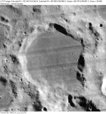
Chamberlin
Contents
Chamberlin
| Lat: 58.88°S, Long: 96°E, Diam: 60.41 km, Depth: km, Rükl: (farside) | |
Images
LPOD Photo Gallery Lunar Orbiter Images Apollo Images
- Chamberlin as seen by a Hasselblad camera of Apollo 15, and captured on color film: AS15-96-13093. In this photograph, the location of Chamberlin is immediately below the frame's centre. See also the Hi-Res scan: AS15-96-13093 HR.
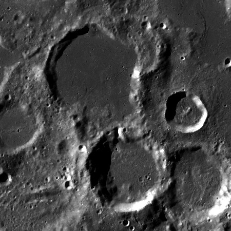
- The 16th item in C.A.Wood's list of Concentric Craters (1978) is the one east of Chamberlin. This Concentric Crater was captured on Lunar Orbiter 4's photograph LOIV-009-h1 (look for the central one in the trio of bowl-shaped craters near the frame's lower left corner).
- Research Apollo 15 and Lunar Orbiter IV photography: Danny Caes.
Maps
(LAC zone 129C2) USGS Digital Atlas PDF
Description
Wikipedia
Additional Information
- IAU page: Chamberlin
- Nearby concentric crater (east of Chamberlin).
Nomenclature
- Named for Thomas Chrowder Chamberlin (September 25, 1843 - November 15, 1928), an influential American geologist and educator. In 1893 he founded the Journal of Geology, of which he was editor for many years. He developed the planetesimal theory, which states that Earth was made from smaller objects that gradually built the planets by accretion. From this theory and other geological evidence he concluded that Earth was much older than assumed by Lord Kelvin (ca 100 million years) at the time.
- The name for this libration zone crater was introduced in the long list of IAU-approved farside names published in Menzel, 1971. - Jim Mosher
LPOD Articles
Bibliography
Named Features -- Prev: Chalonge -- Next: Champollion

