Caventou
Contents
[hide]Caventou
(formerly La Hire D)
|
Lat: 29.8°N, Long: 29.4°W, Diam: 3 km, Depth: 0.3 km, Rükl: 20 |
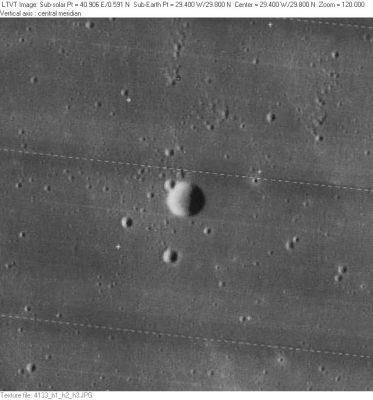
LO-IV-133H

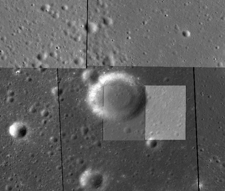
LRO-NAC image
Caventou (La Hire D) and its two small "companions" at 6:30 and 8:00 (which create some sort of "triangle" with Caventou itself; an easy to recognize figure on orbital photographs!).
Images
LPOD Photo Gallery Lunar Orbiter Images Apollo Images
Caventou is noticeable on Apollo 15's orbital ITEK-panoramic frames AS15-P-10278 and AS15-P-10283 (at both frames: scroll to the right).
Orbital FAIRCHILD-metric/mapping photographs of Caventou, made during the mission of Apollo 15:
- REV 60's frames 2069 to 2073, of which frame 2071 shows Caventou about "halfway" between the frame's centre and right margin.
- REV 62's frames 2182 to 2186, of which frame 2184 shows Caventou about "halfway" between the frame's centre and right margin.
- REV 63's frames 2326 to 2330, of which frame 2328 shows Caventou about "halfway" between the frame's centre and right margin.
- REV 70's frames 2466 to 2469, of which frame 2467 shows Caventou near the central part of the frame's right margin.
- REV 72's frames 2733 to 2737, of which frame 2735 shows Caventou near the central part of the frame's right margin.
Research FAIRCHILD and ITEK photographs: Danny Caes
Believe it or not, small rimless Caventou is also detectable on Chart 21 of the 21st Century Atlas of the Moon (C.A.Wood/ M.Collins). Its location is F3, slightly to the right of the unnamed twin which looks like some sort of astronomer's "binary system". - DannyCaes Oct 5, 2013
Maps
(LAC zone 40A1) LAC map Geologic map LTO map
Description
Caventou is a small rimless pit, but... is it a volcanic collapse or an impact crater whose outside is surrounded by mare lavas? No evidence of lava flowing over rim so probably a volcanic collapse. This is the type of inconspicuous crater that should not have been given a name, rather than keeping its historic designation of La Hire D. Other examples of such small inconspicuous IAU-named craters: Amontons and Pupin.
Description: Wikipedia
Additional Information
- Depth data from Kurt Fisher database
- Viscardy, 1985: 0.4 km
- The shadow in LO-IV-133H indicates a depth of about 365 m. - Jim Mosher
- LRO altimetry suggests 300 m {CAW)
Nomenclature
- Joseph-Bienaimé; French chemist, pharmacologist (1795-1877).
- This replacement name for a formerly lettered crater was introduced on LTO 40A1 (for which it served as the chart title). - Jim Mosher
- Misspelled as Cavantou on Map 8 in The Hatfield Photographic Lunar Atlas (Springer, 1999).- DannyCaes Jan 26, 2013
- Although it is a very small craterlet, Caventou' (the name) is printed on the National Geographic Societys revised and reprinted map THE EARTH'S MOON (2014). - DannyCaes Oct 11, 2015
LPOD Articles
Bibliography
