Yoshi
Contents
Yoshi
|
Lat: 24.56°N, Long: 10.99°E, Diam: 0.5 km, Depth: 0.07 km, Rükl: 23 |
Table of Contents
[#Yoshi Yoshi]
[#Yoshi-Images Images]
[#Yoshi-Maps Maps]
[#Yoshi-Description Description]
[#Yoshi-Description-Wikipedia Wikipedia]
[#Yoshi-Additional Information Additional Information]
[#Yoshi-Nomenclature Nomenclature]
[#Yoshi-LPOD Articles LPOD Articles]
[#Yoshi-Bibliography Bibliography]
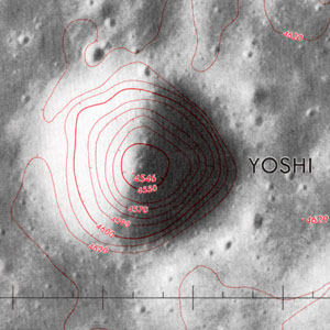
Left: Topophotomap 42A4S1(10) detail; based on AS15-P-9350
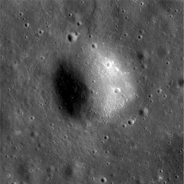
Right: LROC NAC image M104447576LC
Images
LPOD Photo Gallery Lunar Orbiter Images
Maps
(LAC zone 42A4) LAC map Geologic map LM map LTO map Topophotomap
Description
A small bowl-shaped crater at the tip of the western arm of the peculiar volcanic (?) feature Aratus CA.
Wikipedia
Additional Information
- IAU page: Yoshi
- Yoshi is a typical small crater 0.54 km in diameter and it is plotted on Topophotomap 42A4S1(10) at 24.5535°N, 10.9784°E. The depth of 74 m given on the title line is read from the Topophotomap.
- JimMosher JimMosher
Nomenclature
Japanese male name.
- Yoshi is a Minor Feature. The name was originally intended only for use in describing positions on Topophotomap 42A4S1(10) (the only map on which it appears). Along with many other minor features, it was added to the lexicon of IAU Nomenclature in 1976.
LPOD Articles
Bibliography
Greeley, R. (1976). Photogeology of Aratus CA, Mare Serenitatis. Abstracts of the Lunar and Planetary Science Conference 7 (2): 331.
 Apollo Over the Moon, Chapter 7: Unusual Features (Part 1), Figure 223 (Aratus CA).
Named Features -- Prev: Yerkes -- Next: Young
This page has been edited 1 times. The last modification was made by - tychocrater tychocrater on Jun 13, 2009 3:24 pm - afx1u3

