Bhabha
Contents
Bhabha
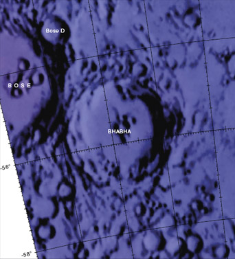
| Lat: 55.1°S, Long: 164.5°W, Diam: 64 km, Depth: km, Rükl: (farside) | |
Table of Contents
Images
LPOD Photo Gallery Lunar Orbiter Images Apollo Images
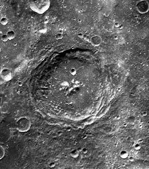
- A low-angle LROC view of Bhabha showing most of the crater's interior (other than the tops of the central peaks) in shadow.

- Zoomable version
Maps
(LAC zone 133A4) USGS Digital Atlas PDF
Description
Bhabha lies close to the central regions of the South Pole Aitken Basin (SPA-B) -- a 2500 kilometre-wide basin of the pre-Nectarian period (~ 4.6 to 3.92 bn years) whose centre is approximately at 54.2S, 168.7W. Aged as Nectarian (~ 3.92 to 3.85 bn years), the crater looks relatively fresh with sharp-looking terraced walls all around -- except for its eastern section where the rim has been altered by movement of material (or is it impact-related?). The floor is flat showing signs of a dark-ish material in the south-eastern portion, and the whole inner area is topped off with a series of cental peaks that open towards the north. - JohnMoore2 JohnMoore2
Description: Wikipedia
Additional Information
- Central peak composition: AGN, AN, GN & G (Tompkins & Pieters, 1999)
- Within SPA basin, less than 90% anorthosite in central peak, and 0.1 to 0.6 Maturity Index (not mature) Ohtake and others, 2009
- Ohtake and others, 2009 give a diameter of 78 km; the IAU value (above) differs.
Nomenclature
- Named for Homi Jehangir (1909-1966), an Indian physicist.
- This name was introduced into the IAU nomenclature in the long list of farside names published in Menzel, 1971.
LROC Articles
Bhabha sinks into the shadows.
LPOD Articles
Bibliography
This page has been edited 1 times. The last modification was made by - tychocrater tychocrater on Jun 13, 2009 3:24 pm - afx3u2

