AIC
Contents
Apollo Intermediate Charts
(glossary entry)Table of Contents
[#Apollo Intermediate Charts Apollo Intermediate Charts]
[#Apollo Intermediate Charts-Description Description]
[#Apollo Intermediate Charts-Additional Information Additional Information]
[#Apollo Intermediate Charts-Accuracy Accuracy]
[#Apollo Intermediate Charts-LPOD Articles LPOD Articles]
[#Apollo Intermediate Charts-Bibliography Bibliography]
Description
The Apollo Intermediate Chart series was prepared by a predecessor of the DMA between 1965 and 1967. These charts were meant to supplement the LAC map series. They each cover one-quarter of an LAC zone, permitting the features to be shown with greater detail. The 20 maps prepared all fall in the Moon’s equatorial zone and were based on photographic evidence supplemented by visual observations at the Lowell Observatory. Each zone was printed both (on the front) in a labeled form similar to the LAC's and (on the reverse side) in a second form without the labels but with regions of interest highlighted and notes about them by the observer.
Additional Information
- Both versions of each of the 20 regions mapped in the AIC Series can be downloaded from the LPI website.
- See History of the LAC maps for more about the production of this very closely related series produced for targeting the first Lunar Orbiter missions to photograph potential Surveyor and Apollo landing sites.
- Although the AIC series show more detail than the LAC's, the observer notes frequently refer to still smaller details and features not represented in the airbrushed renderings.
Accuracy
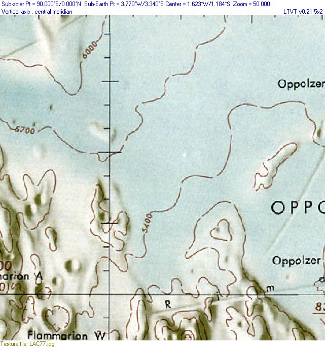
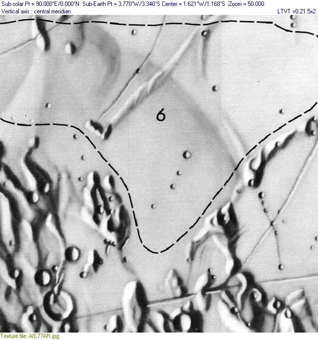
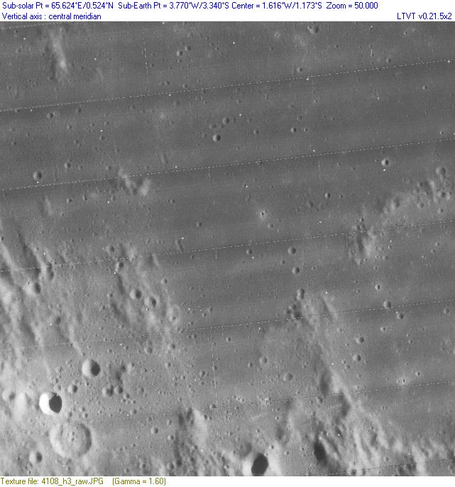
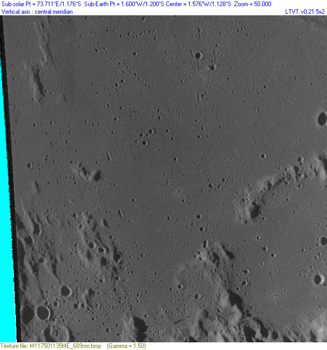
- The following thumbnails (click to view at full size) compare a region near the Moon's center as portrayed in LAC 77 and as "improved" in AIC 77 with the detail later photographed by Lunar Orbiter (frame LOIV-108H), all at the same scale, and by the LRO Wide Angle Camera (frame M117501135ME):
| LAC 77 |
AIC 77A |
LOIV-108H |
LRO WAC |
- According to observer James Greenacre's notes to AIC 77, the region depicted ("Area 6," in the upper right of the all linked images) was scrutinized especially closely, yet only a little of the detail added was found by Lunar Orbiter.
- Although the LRO WAC view has considerable geometric distortion in need of professional correction, it is sufficient to confirm that most of the added detail, including the prominent diagonal ridge and rille, are imaginary.
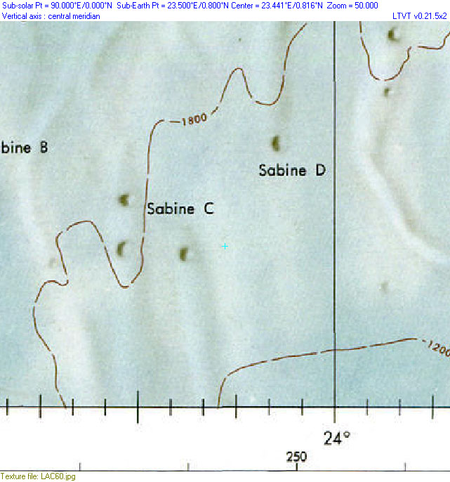
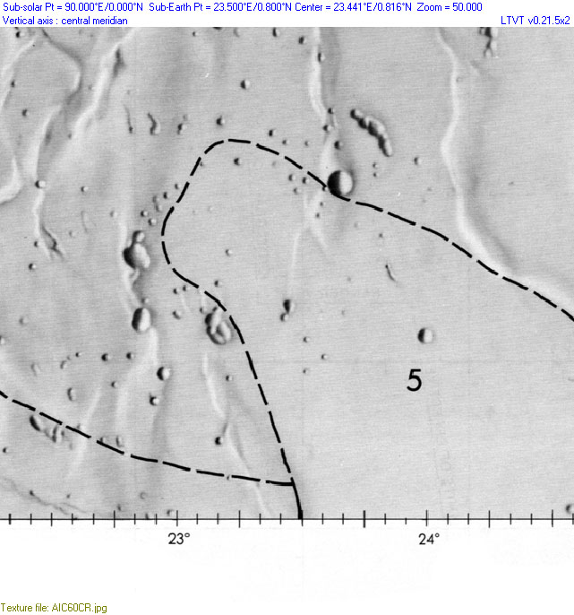
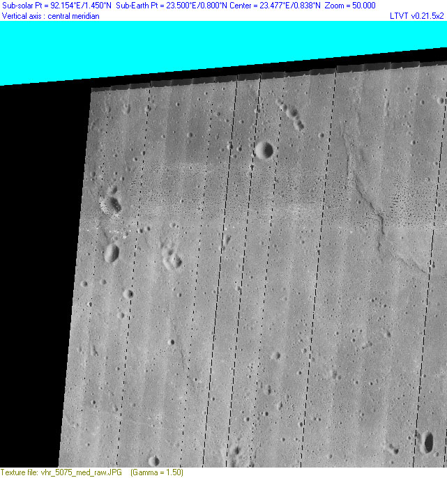
- Here is a second example showing the area of the Apollo 11 Landing Site (in the center of the field) as seen in LAC 60, AIC 60C and Lunar Orbiter frame LOV-075M:
| LAC 60 |
AIC 60C |
LOV-075M |
- According to the notes, of the "enhancements" in the AIC map, those on the left side of "Area 5" are based on Ranger VIII photos and are quite accurate. The right hand side was enhanced visually by the observer, Leonard J. Martin and does not have the same reliability. The 2-km diameter crater shown above the "5" was not found by Lunar Orbiter.
LPOD Articles
Bibliography
This page has been edited 1 times. The last modification was made by - tychocrater tychocrater on Jun 13, 2009 3:24 pm - mgx2
