Rupes Boris
Contents
Rupes Boris
|
Lat: 30.5°N, Long: 33.5°W, Length: 4 km, Height: km, Rükl: 9 |
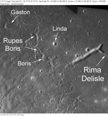
AS15-M-2470 This small region northeast of Delisle was the subject of a Topophotomap which is the source of several IAU-approved minor feature names: Boris, Gaston, Linda and Rupes Boris. Rupes Boris refers to a minor step in elevation detected in the stereo mapping. The shadows in this photo make it appear more of a ridge. The large trench-like depression at one end of Rima Delisle is unnamed.
Images
LPOD Photo Gallery Lunar Orbiter Images Apollo Images
Maps
(LAC zone 39B2) LAC map Geologic map LM map LTO map Topophotomap
Description
Rupes Boris is not a fault. It is a ridge that is part of the ejecta of the fresh crater Delisle. In any case this feature is too minor to warrant a name, much less a name that gives an incorrect classification.
Description: Wikipedia
Additional Information
Nomenclature
Named from nearby crater. (Boris)
- According to NASA RP-1097, "Rupes Boris" is a Minor Feature whose name was originally intended only for use in connection with Topophotomap 39B2/S2(on which it is plotted).
LPOD Articles
Bibliography
