Difference between revisions of "Rima Hansteen"
| Line 6: | Line 6: | ||
|} | |} | ||
<div id="toc"> | <div id="toc"> | ||
| − | [http://www.lpod.org/coppermine/albums/userpics/Rima_Hansteen_LO-IV-156H_LTVT.JPG [[Image: | + | [http://www.lpod.org/coppermine/albums/userpics/Rima_Hansteen_LO-IV-156H_LTVT.JPG [[Image:Normal_Rima_Hansteen_LO-IV-156H_LTVT.JPG|external image normal_Rima_Hansteen_LO-IV-156H_LTVT.JPG]]]<br /> ''[http://lpod.org/coppermine/displayimage.php?pos=-2004 LO-IV-156H]''<br /> <br /> |
==Images== | ==Images== | ||
[http://www.lpod.org/coppermine/thumbnails.php?album=search&type=full&search=Rima%20Hansteen LPOD Photo Gallery] [http://www.lpi.usra.edu/resources/lunar_orbiter/bin/srch_nam.shtml?Rima%20Hansteen%7C0 Lunar Orbiter Images]<br /> <br /> | [http://www.lpod.org/coppermine/thumbnails.php?album=search&type=full&search=Rima%20Hansteen LPOD Photo Gallery] [http://www.lpi.usra.edu/resources/lunar_orbiter/bin/srch_nam.shtml?Rima%20Hansteen%7C0 Lunar Orbiter Images]<br /> <br /> | ||
Latest revision as of 02:11, 16 April 2018
Contents
Rima Hansteen
|
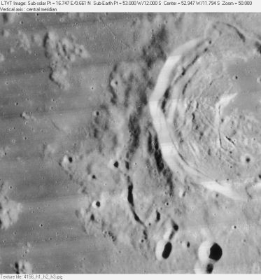
Lat: 12.0°S, Long: 53.0°W, Length: 25 km, Depth: km, Rükl: 40 |
Images
LPOD Photo Gallery Lunar Orbiter Images
Maps
(LAC zone 74C3) LAC map Geologic map
Description
Description: Wikipedia
Additional Information
Nomenclature
Named from nearby crater. (Hansteen)
 Rimae Hansteen (an unofficial name for the system of rilles on the floor of crater Hansteen).
LPOD Articles
Bibliography
