Difference between revisions of "Babakin"
| Line 4: | Line 4: | ||
| Lat: 20.8°S, Long: 123.3°E, Diam: 20 km, Depth: km, Rükl: ''(farside)''<br /> | | Lat: 20.8°S, Long: 123.3°E, Diam: 20 km, Depth: km, Rükl: ''(farside)''<br /> | ||
|} | |} | ||
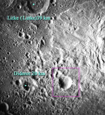
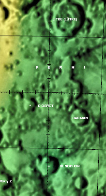
| − | [http://www.lpod.org/coppermine/displayimage.php?pid=4110&fullsize=1 [[Image: | + | [http://www.lpod.org/coppermine/displayimage.php?pid=4110&fullsize=1 [[Image:Babakin.jpg|babakin.jpg]]][[Image:Bab-did-color.jpg|bab-did-color.jpg]]<br /> (Left) ''[http://the-moon.us/wiki/file/detail/babakin.jpg Annotated]'' from [http://www.lpi.usra.edu/resources/apollo/frame/?AS15-M-1035 AS15-M-1035] Note: west is top, north is right in the linked image. (Right) [http://planetarynames.wr.usgs.gov/images/Lunar/lac_101.pdf Color-coded LAC 101] from the [http://the-moon.us/wiki/USGS%20Digital%20Atlas USGS Digital Atlas]<br /> <div id="toc"> |
==Images== | ==Images== | ||
Revision as of 01:41, 16 April 2018
Contents
Babakin - on the floor of Fermi
| Lat: 20.8°S, Long: 123.3°E, Diam: 20 km, Depth: km, Rükl: (farside) |


(Left) Annotated from AS15-M-1035 Note: west is top, north is right in the linked image. (Right) Color-coded LAC 101 from the USGS Digital Atlas
Images
LPOD Photo Gallery Lunar Orbiter Images Apollo Images
- Large printable version of AS15-M-1035.
- Babakin was also captured on Apollo 17's orbital panoramic ITEK-camera frames AS17-P-2783 and AS17-P-2790- DannyCaes Oct 29, 2012
Maps
Description
Babakin lies almost in the centre of the 183 km diameter-wide, pre-Nectarian crater (~ 4.6 to 3.92 bn years) Fermi. Having several small, pit-like craters in its centre as well on most of its rim, the crater displays a typical characteristic bowl-shaped appearance. The northern and western portions of the rim appears more worn, and a close-up view shows collapsed material within the crater itself about these regions. As Babakin appears to have impacted upon ejecta from mare-filled Tsiolkovskiy nearby -- a 185 km diameter crater of the Late Imbrium (3.8 - 3.2 bn years) period and out of picture to the east -- the crater may therefore be younger. - JohnMoore2 JohnMoore2
Description: Wikipedia
Additional Information
Nomenclature
- Named for Georgi Nikolaevich Babakin (November 14, 1914 - August 3, 1971), a Soviet engineer working in the space program. He was Chief Designer at the Lavochkin Design Bureau from 1965 until his death.
- Babakin serves as the title of LTO-101B4 (April, 1974).
- Babakin was not in the initial list of IAU-approved farside names announced in Menzel, 1971. Instead, it appears without explanation in the cumulative list of approved names printed in IAU Transactions XVB (1973), which is given as the approval date in the IAU Planetary Gazetteer. It is unclear if the crater had a previous letter designation. Babakin was also used to name a crater on Mars in 1985.
LPOD Articles
Bibliography