Difference between revisions of "Timaeus"
| Line 14: | Line 14: | ||
<br /> | <br /> | ||
==Description: Elger== | ==Description: Elger== | ||
| − | ''([[IAU% | + | ''([[IAU%20directions|IAU Directions]])'' TIMAEUS.--A very bright ring-plain, 22 miles in diameter, with walls about 4,500 feet in height, on the coast-line of the [[Mare%20Frigoris|Mare Frigoris]], and associated with the W. side of the great enclosed plain [[W.%20Bond|W.C. Bond]]. Schmidt shows a double hill, nearly central, and Neison a crater on the S.E. wall.<br /> <br /> |
==Description: Wikipedia== | ==Description: Wikipedia== | ||
[http://en.wikipedia.org/wiki/Timaeus_(crater) Timaeus]<br /> <br /> | [http://en.wikipedia.org/wiki/Timaeus_(crater) Timaeus]<br /> <br /> | ||
==Additional Information== | ==Additional Information== | ||
| − | Depth data from [[Kurt%20Fisher% | + | Depth data from [[Kurt%20Fisher%20Crater%20Depths|Kurt Fisher database]]<br /> |
* Westfall, 2000: 3.23 km | * Westfall, 2000: 3.23 km | ||
* Cherrington, 1969: 2.25 km | * Cherrington, 1969: 2.25 km | ||
| Line 25: | Line 25: | ||
Central peak height<br /> | Central peak height<br /> | ||
| − | * [[Sekiguchi%2C%201972|Sekiguchi, 1972]]: 0.8 km <span class="membersnap">- [http://www.wikispaces.com/user/view/fatastronomer [[Image: | + | * [[Sekiguchi%2C%201972|Sekiguchi, 1972]]: 0.8 km <span class="membersnap">- [http://www.wikispaces.com/user/view/fatastronomer [[Image:Fatastronomer-lg.jpg|16px|fatastronomer]]] [http://www.wikispaces.com/user/view/fatastronomer fatastronomer]</span> |
* Measures on LRO QuickMap give central peak height about 500 m | * Measures on LRO QuickMap give central peak height about 500 m | ||
* Small concentric rille suggest this could be a floor-fractured crater. | * Small concentric rille suggest this could be a floor-fractured crater. | ||
Revision as of 03:19, 16 April 2018
Contents
Timaeus
|
Lat: 62.8°N, Long: 0.5°W, Diam: 32 km, Depth: 2.1 km, Rükl:4, Upper Imbrian |
Images
LPOD Photo Gallery Lunar Orbiter Images
Maps
(LAC zone 12B1) LAC map Geologic map
Description
Description: Elger
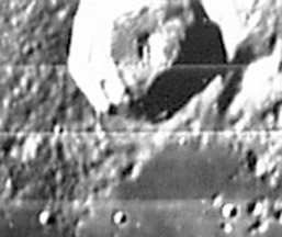
(IAU Directions) TIMAEUS.--A very bright ring-plain, 22 miles in diameter, with walls about 4,500 feet in height, on the coast-line of the Mare Frigoris, and associated with the W. side of the great enclosed plain W.C. Bond. Schmidt shows a double hill, nearly central, and Neison a crater on the S.E. wall.
Description: Wikipedia
Additional Information
Depth data from Kurt Fisher database
- Westfall, 2000: 3.23 km
- Cherrington, 1969: 2.25 km
- Measures on LRO QuickMap give depth range of about 1.8 to 2.5 km, ave about 2.1 km
Central peak height
- Sekiguchi, 1972: 0.8 km - fatastronomer fatastronomer
- Measures on LRO QuickMap give central peak height about 500 m
- Small concentric rille suggest this could be a floor-fractured crater.
Nomenclature
Timaeus (ca. 345—ca. 250 BC) was an ancient Greek historian. His great historical work was The Histories, probably some 40 books. This work was divided into unequal sections, containing the history of Greece from its earliest days till the first Punic war.
LPOD Articles
Bibliography
