Difference between revisions of "Mare Serenitatis"
| Line 6: | Line 6: | ||
Lat: 28.0°N, Long: 17.5°E, Main ring diam: 920 km, Basin depth: 2.14 km, [[R%C3%BCkl%2023|Rükl: 23]]<br /> | Lat: 28.0°N, Long: 17.5°E, Main ring diam: 920 km, Basin depth: 2.14 km, [[R%C3%BCkl%2023|Rükl: 23]]<br /> | ||
|} | |} | ||
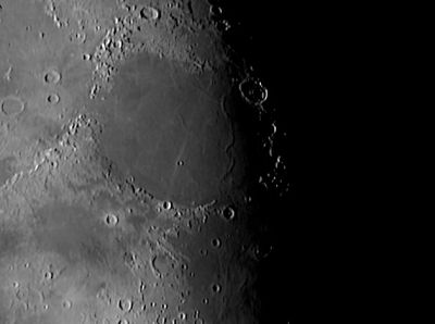
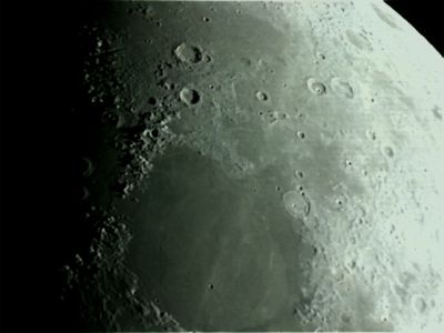
| − | [http://www.lpod.org/coppermine/displayimage.php?pid=1780&fullsize=1 [[Image: | + | [http://www.lpod.org/coppermine/displayimage.php?pid=1780&fullsize=1 [[Image:Normal_MSerenitatis050923.jpg|external image normal_MSerenitatis050923.jpg]]][http://www.lpod.org/coppermine/displayimage.php?pid=1991&fullsize=1 [[Image:Normal_Bessel_MSeren_SJP_7-21-2007.jpg|external image normal_Bessel_MSeren_SJP_7-21-2007.jpg]]]<br /> Left: ''[http://lpod.org/coppermine/displayimage.php?pos=-1780 Peter Lloyd]'' Right: ''[http://lpod.org/coppermine/displayimage.php?pos=-1991 Simon J. Porter]''<br /> <br /> <br /> <div id="toc"> |
==Images== | ==Images== | ||
| Line 35: | Line 35: | ||
[http://en.wikipedia.org/wiki/Mare_Serenitatis Mare Serenitatis]<br /> <br /> | [http://en.wikipedia.org/wiki/Mare_Serenitatis Mare Serenitatis]<br /> <br /> | ||
==Additional Information== | ==Additional Information== | ||
| − | * Depth data from [[Kurt%20Fisher% | + | * Depth data from [[Kurt%20Fisher%20Crater%20Depths|Kurt Fisher database]] |
** Pike, 1976: 2.5 km | ** Pike, 1976: 2.5 km | ||
* Mare area of 353,400 km^2 according to measurements by [http://www.lpod.org/cwm/DataStuff/MareAreas.htm Jim Whitford-Stark]. | * Mare area of 353,400 km^2 according to measurements by [http://www.lpod.org/cwm/DataStuff/MareAreas.htm Jim Whitford-Stark]. | ||
| Line 41: | Line 41: | ||
* Detection of '''Mare Serenitatis''''s south-southeastern part on the cover of Eno's Apollo-album: Danny Caes | * Detection of '''Mare Serenitatis''''s south-southeastern part on the cover of Eno's Apollo-album: Danny Caes | ||
* Two of the Apollo Project's orbital ''Fairchild'' Camera photographs of '''Mare Serenitatis''' are included in the book FULL MOON by Michael Light and Andrew Chaikin (plates 35 and 36). These photographs are: [http://www.lpi.usra.edu/resources/apollo/frame/?AS17-M-0452 AS17-M-0452] (plate 35) and [http://www.lpi.usra.edu/resources/apollo/frame/?AS17-M-0454 AS17-M-0454] (plate 36). D.Caes research. | * Two of the Apollo Project's orbital ''Fairchild'' Camera photographs of '''Mare Serenitatis''' are included in the book FULL MOON by Michael Light and Andrew Chaikin (plates 35 and 36). These photographs are: [http://www.lpi.usra.edu/resources/apollo/frame/?AS17-M-0452 AS17-M-0452] (plate 35) and [http://www.lpi.usra.edu/resources/apollo/frame/?AS17-M-0454 AS17-M-0454] (plate 36). D.Caes research. | ||
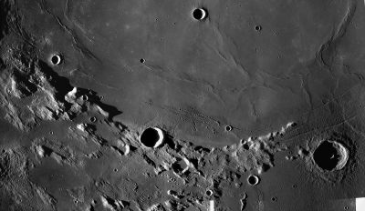
| − | * Image below is a ''[http://lroc.sese.asu.edu/index.html LROC]'' WAC mosaic (No.'s [http://wms.lroc.asu.edu/lroc/view_lroc/LRO-L-LROC-2-EDR-V1.0/M117359028ME M117359028ME], [http://wms.lroc.asu.edu/lroc/view_lroc/LRO-L-LROC-2-EDR-V1.0/M117420091ME M117420091ME], [http://wms.lroc.asu.edu/lroc/view_lroc/LRO-L-LROC-2-EDR-V1.0/M117386175ME M117386175ME], [http://wms.lroc.asu.edu/lroc/view_lroc/LRO-L-LROC-2-EDR-V1.0/M117352260ME M117352260ME], [http://wms.lroc.asu.edu/lroc/view_lroc/LRO-L-LROC-2-EDR-V1.0/M117413324ME M117413324ME], [http://wms.lroc.asu.edu/lroc/view_lroc/LRO-L-LROC-2-EDR-V1.0/M117379381ME M117379381ME], [http://wms.lroc.asu.edu/lroc/view_lroc/LRO-L-LROC-2-EDR-V1.0/M117345465ME M117345465ME], [http://wms.lroc.asu.edu/lroc/view_lroc/LRO-L-LROC-2-EDR-V1.0/M117406530ME M117406530ME], [http://wms.lroc.asu.edu/lroc/view_lroc/LRO-L-LROC-2-EDR-V1.0/M117372616ME M117372616ME], [http://wms.lroc.asu.edu/lroc/view_lroc/LRO-L-LROC-2-EDR-V1.0/M117338672ME M117338672ME], [http://wms.lroc.asu.edu/lroc/view_lroc/LRO-L-LROC-2-EDR-V1.0/M117399736ME M117399736ME], [http://wms.lroc.asu.edu/lroc/view_lroc/LRO-L-LROC-2-EDR-V1.0/M117331904ME M117331904ME], [http://wms.lroc.asu.edu/lroc/view_lroc/LRO-L-LROC-2-EDR-V1.0/M117392969ME M117392969ME]) of the south-west portion of the basin. Processed by [http://ltvt.wikispaces.com/Utility%20Programs#WAC_Viewer LROC_WAC_Previewer]. ''Click for larger view.''<br /> [http://www.lpod.org/coppermine/displayimage.php?pid=4871&fullsize=1 [[Image: | + | * Image below is a ''[http://lroc.sese.asu.edu/index.html LROC]'' WAC mosaic (No.'s [http://wms.lroc.asu.edu/lroc/view_lroc/LRO-L-LROC-2-EDR-V1.0/M117359028ME M117359028ME], [http://wms.lroc.asu.edu/lroc/view_lroc/LRO-L-LROC-2-EDR-V1.0/M117420091ME M117420091ME], [http://wms.lroc.asu.edu/lroc/view_lroc/LRO-L-LROC-2-EDR-V1.0/M117386175ME M117386175ME], [http://wms.lroc.asu.edu/lroc/view_lroc/LRO-L-LROC-2-EDR-V1.0/M117352260ME M117352260ME], [http://wms.lroc.asu.edu/lroc/view_lroc/LRO-L-LROC-2-EDR-V1.0/M117413324ME M117413324ME], [http://wms.lroc.asu.edu/lroc/view_lroc/LRO-L-LROC-2-EDR-V1.0/M117379381ME M117379381ME], [http://wms.lroc.asu.edu/lroc/view_lroc/LRO-L-LROC-2-EDR-V1.0/M117345465ME M117345465ME], [http://wms.lroc.asu.edu/lroc/view_lroc/LRO-L-LROC-2-EDR-V1.0/M117406530ME M117406530ME], [http://wms.lroc.asu.edu/lroc/view_lroc/LRO-L-LROC-2-EDR-V1.0/M117372616ME M117372616ME], [http://wms.lroc.asu.edu/lroc/view_lroc/LRO-L-LROC-2-EDR-V1.0/M117338672ME M117338672ME], [http://wms.lroc.asu.edu/lroc/view_lroc/LRO-L-LROC-2-EDR-V1.0/M117399736ME M117399736ME], [http://wms.lroc.asu.edu/lroc/view_lroc/LRO-L-LROC-2-EDR-V1.0/M117331904ME M117331904ME], [http://wms.lroc.asu.edu/lroc/view_lroc/LRO-L-LROC-2-EDR-V1.0/M117392969ME M117392969ME]) of the south-west portion of the basin. Processed by [http://ltvt.wikispaces.com/Utility%20Programs#WAC_Viewer LROC_WAC_Previewer]. ''Click for larger view.''<br /> [http://www.lpod.org/coppermine/displayimage.php?pid=4871&fullsize=1 [[Image:Normal_south-serenitatis.jpg|external image normal_south-serenitatis.jpg]]] |
<br /> | <br /> | ||
==Nomenclature== | ==Nomenclature== | ||
Latest revision as of 02:03, 16 April 2018
Contents
Serenitatis Basin
(unofficial name; IAU feature name for central 707 km of mare: Mare Serenitatis)
|
Lat: 28.0°N, Long: 17.5°E, Main ring diam: 920 km, Basin depth: 2.14 km, Rükl: 23 |


Left: Peter Lloyd Right: Simon J. Porter
Images
LPOD Photo Gallery Lunar Orbiter Images Apollo Images
Maps
(LAC zone 42A3) LAC map Geologic map LM map LTO map
Basin Classification
(description of terms and most numeric basin data from Wood, C.A. (2004) Impact Basin Database)
| Certainty of Existence |
USGS Age |
Wilhelms Age Group |
Ring Diameters |
Mare Thickness |
Mascon |
| Probable |
Nectarian |
11 |
410, 620, 920, 1300, 1800 km |
1.3-4.3 km |
Yes; +102 mG gravity anomaly |
Description
Description: Wikipedia
Additional Information
- Depth data from Kurt Fisher database
- Pike, 1976: 2.5 km
- Mare area of 353,400 km^2 according to measurements by Jim Whitford-Stark.
- The south-southeastern part of Mare Serenitatis (at Rimae Plinius and Dorsum Nicol) is depicted on the cover of the album APOLLO: ATMOSPHERES AND SOUNDTRACKS by Brian Eno, Daniel Lanois, and Roger Eno (1982). This orbital handheld Hasselblad photograph (AS17-150-23069) looks great on the L.P.-edition which appeared in the early eighties!
- Detection of Mare Serenitatis's south-southeastern part on the cover of Eno's Apollo-album: Danny Caes
- Two of the Apollo Project's orbital Fairchild Camera photographs of Mare Serenitatis are included in the book FULL MOON by Michael Light and Andrew Chaikin (plates 35 and 36). These photographs are: AS17-M-0452 (plate 35) and AS17-M-0454 (plate 36). D.Caes research.
- Image below is a LROC WAC mosaic (No.'s M117359028ME, M117420091ME, M117386175ME, M117352260ME, M117413324ME, M117379381ME, M117345465ME, M117406530ME, M117372616ME, M117338672ME, M117399736ME, M117331904ME, M117392969ME) of the south-west portion of the basin. Processed by LROC_WAC_Previewer. Click for larger view.

Nomenclature
The IAU feature name means "Sea of Serenity".
- Named Regio Magna Occidentalis (Large Western Region) in pre-telescopic sketch map by William Gilbert in ~1600 - Name also included most other eastern maria! [Whitaker: Mapping and Naming the Moon, p 15]
- The impact basin is named after the mare.
The Bessel Ray (the first named example of this kind of high-albedo rays?)
The 21st Century Atlas of the Moon (Charles A. Wood/ Maurice J.S. Collins) is perhaps the very first lunar atlas which has a name for the mysterious high-albedo ray running across Mare Serenitatis and crater Bessel. This ray is one of the most stubborn riddles in the history of moon observing and selenography. What is the source of this remarkable singular ray of ejecta? Is Bessel the source? Or is it a crater to the north of Mare Serenitatis? Or perhaps to the south? It's very strange that this kind of pronounced rays (ejecta rays from impact craters) don't have official IAU names. Anyway, Chart 11 (page 35) in the 21st Century Atlas of the Moon shows the informal name Bessel Ray just north of crater Bessel. How many (ancient or recent) moonbooks have a description of the mysterious Bessel Ray in Mare Serenitatis?
LPOD Articles
Serenitatis in Black and White and Gray
Serenitatis Diameter Sequence
Make Your Own Atlas
Bright Moon (Mare Serenitatis during Full Moon).
Lunar 100
L18: Distinct mare areas with different compositions.
Bibliography
- The southern regions of Mare Serenitatis:
  APOLLO OVER THE MOON; A VIEW FROM ORBIT, Chapter 4: The Maria (Part 1), Figure 58.
  - The eastern coastline of Mare Serenitatis:
  AOTM, Chapter 2: Regional views, Figure 27.
  AOTM, Chapter 4: The Maria (Part 2), Figure 74.
  - The western coastline of Mare Serenitatis:
  AOTM, Chapter 2: Regional views, Figure 28.