Difference between revisions of "Diderot"
| Line 4: | Line 4: | ||
| Lat: 20.4°S, Long: 121.5°E, Diam: 20 km, Depth: km, Rükl: ''(farside)''<br /> | | Lat: 20.4°S, Long: 121.5°E, Diam: 20 km, Depth: km, Rükl: ''(farside)''<br /> | ||
|} | |} | ||
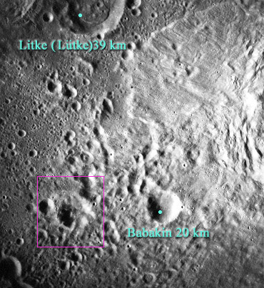
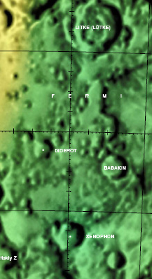
| − | [[Image: | + | [[Image:Diderot.jpg|diderot.jpg]][[Image:Bab-did-color.jpg|bab-did-color.jpg]]<br /> (Left) ''[http://the-moon.us/wiki/file/detail/diderot.jpg Annotated]'' from [http://www.lpi.usra.edu/resources/apollo/frame/?AS15-M-1035 AS15-M-1035][http://www.lpi.usra.edu/resources/apollo/images/print/AS15/M/1035.jpg (larger printable version)]. Note, west is top, north is right in these linked images. (Right) [http://planetarynames.wr.usgs.gov/images/Lunar/lac_101.pdf Color-coded LAC 101] from [http://planetarynames.wr.usgs.gov/dAtlas.html?map=shaded USGS Digital Atlas of the Moon]<br /> <div id="toc"> |
==Images== | ==Images== | ||
Revision as of 01:46, 16 April 2018
Contents
Diderot
| Lat: 20.4°S, Long: 121.5°E, Diam: 20 km, Depth: km, Rükl: (farside) |


(Left) Annotated from AS15-M-1035(larger printable version). Note, west is top, north is right in these linked images. (Right) Color-coded LAC 101 from USGS Digital Atlas of the Moon
Images
LPOD Photo Gallery Lunar Orbiter Images Apollo Images
Diderot was captured on Apollo 17's orbital panoramic ITEK-camera frames AS17-P-2787 and AS17-P-2794.
Research: Danny Caes
Maps
Description
Diderot lies in the 183 km diameter-wide, pre-Nectarian crater (~ 4.6 to 3.92 bn years) Fermi. Unlike similar-sized (20 km) Babakin crater just to its right, Diderot's worn-looking rim is barely perceptable. Most, if not all, of its north-eastern portion has either collapsed into its floor or has been affected in some way by impact ejecta from mare-filled Tsiolkovskiy nearby -- a 185 km diameter crater of the Late Imbrium (3.8 - 3.2 bn years) period and out of picture to the east. - JohnMoore2 JohnMoore2
Description: Wikipedia
Additional Information
Nomenclature
Denis; French philosopher (1713-1784).
LPOD Articles
Bibliography